")
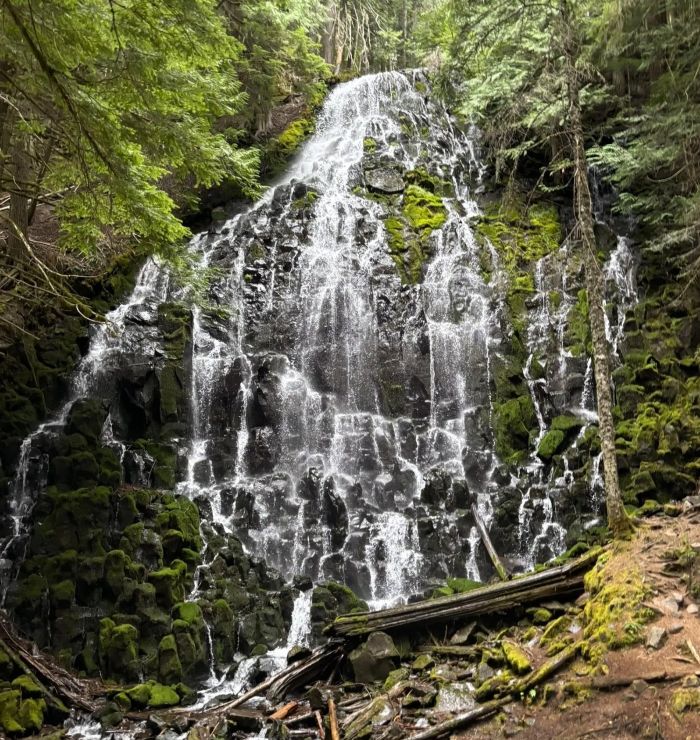
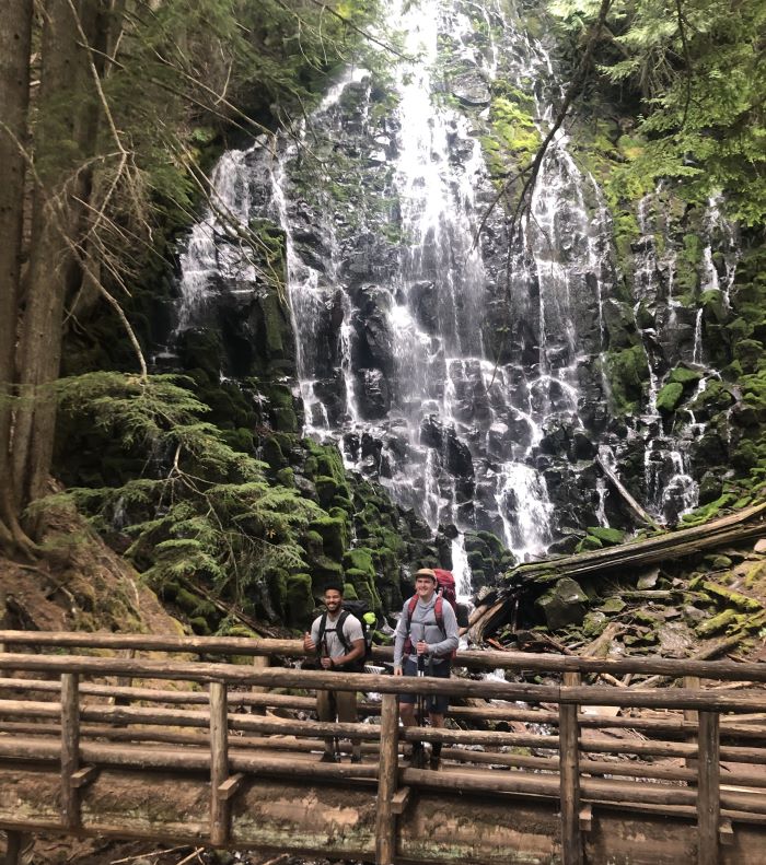
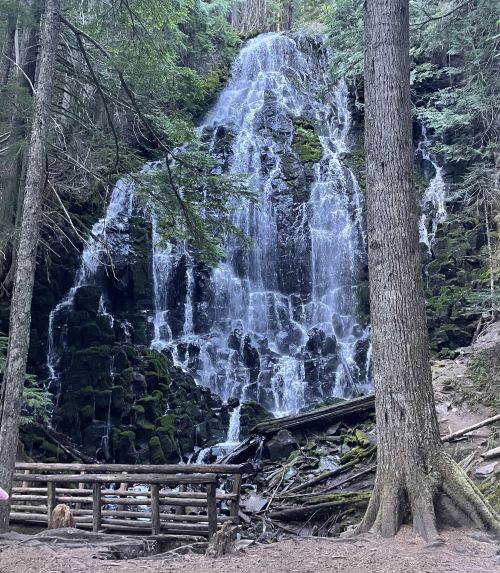
Ramona Falls Oregon is a stunning waterfall on the western side of Mt. Hood.
In fact, we consider Ramona Falls to be one of the top waterfalls in Oregon and definitely worth a visit.
In this article, we’ll cover everything you need to know about visiting Ramona Falls, including what to expect for the Ramona Falls Oregon hike.
We’ve visited Ramona Falls (and the Mt. Hood area) many times, and we’ve gathered our local knowledge here to help you plan.
Without delay, let’s cascade into one of the best waterfalls in Oregon: Ramona Falls.
Ramona Falls Oregon: Overview
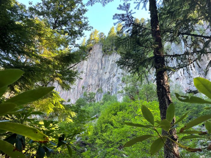
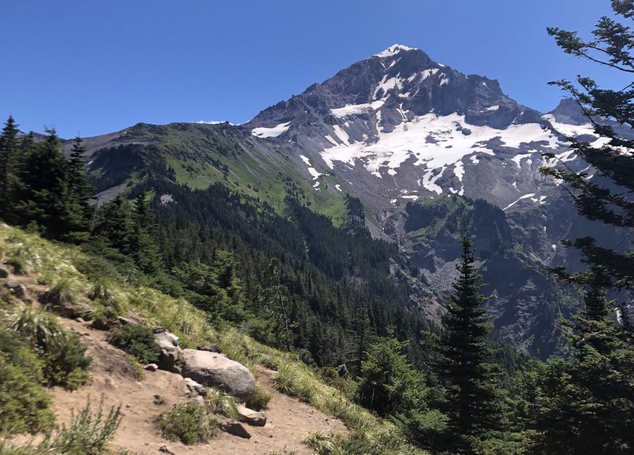
Ramona Falls is a 120-foot (37 meter) waterfall fed by rain and snowmelt on the west side of Mt. Hood in Oregon, within the beautiful Mount Hood Wilderness.
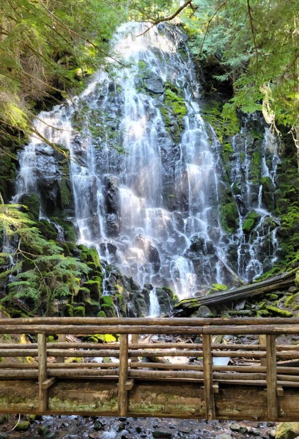
Tumbling over a hillside within a dense forest, Ramona Falls is incredible scenic and the hike to get there is serene as well.
Ramona Falls at a Glance
If you’re short on time, we’ve summarized the most important points of this article in the list below. Of course, we go into more details later.
- Gravel road to trailhead (usually in good shape).
- Accessible year round, but road closure and snow on trails during winter.
- 7 miles round trip from trailhead to falls. 1000 feet of elevation gain.
- River crossing required. No bridge. Usually fairly easy.
- USFS Recreation Pass required from May 1 to October 31st.
- Trail gets crowded on weekends with nice weather.
Getting to Ramona Falls
To access the Ramona Falls Trailhead, turn off of Highway 26 in Zig Zag onto E Lolo Pass Road. After about 4 miles, turn right onto Muddy Fork Road.
Shortly after, turn right to cross the bridge over the Sandy River and continue about 2 miles further towards the trailhead.
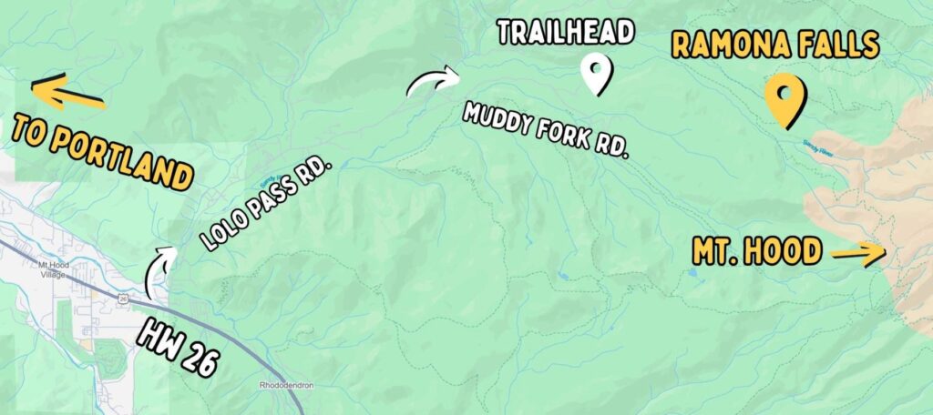
Keep in mind: There are dirt roads, but they are usually kept in good shape due to the popularity of the trail, so most vehicles should be fine.
The table below shows the driving distance and typical travel time to the Ramona Falls Trailhead from various locations in Oregon.
| Starting Location | Distance | Typical Drive Time |
| Sandy | 24 miles | 35 minutes |
| Portland | 52 miles | 1 hour 15 minutes |
| Government Camp | 18 miles | 30 minutes |
| Bend | 125 miles | 2 hours 20 minutes |
The trailhead has a large parking lot that can hold about 50 cars. That said, this does fill up on crowded weekends.
From the trailhead, the hike to Ramona Falls is just over 7 miles round-trip (3.5 miles each way) and can be done as a partial loop (see the map below).
Ramona Falls Map
Use the interactive map below to get your bearings. You can also expand it to view a new window.
When to Visit Ramona Falls
The best time to explore Ramona Falls from May through October, when temperatures are warmer and there is no snow on the trails.
We especially love visiting this refreshing waterfall on a hot summer day. The mist from the falls is a great way to cool off and the hike is mostly shaded.
Keep in mind: Summer weekends are almost always crowded at Ramona Falls. To beat the crowds, leave early in the morning or go for a sunset hike.
Fall can be a great time as well. Trees like the Vine Maple and Big Leaf Maple can have beautiful colors if you time it right.
Though you can visit during winter, you should be prepared for snow on the trails, downed trees, and road closures. More on visiting Ramona Falls during winter later.
When spring comes around, enjoy warmer temperatures and budding plants, but also be aware of downed trees that have not yet been maintained.
Ramona Falls Hike
Most people start the hike to Ramona Falls from the Ramona Falls Trailhead (which is what we recommend for day hikers.
From the trailhead, the hike is just over 7 miles round-trip, with about 1,000 feet of elevation gain.
Check out the official USFS webpage for the Ramona Falls Trail.
The trail is known as a lollipop loop, or a partial loop, because it has a junction partway that allows two ways to access the falls.
While you can do it as an out-and-back, we recommend doing the loop because you get to see more of the area. The north part of the loop is quite pretty and goes through a unique canyon.
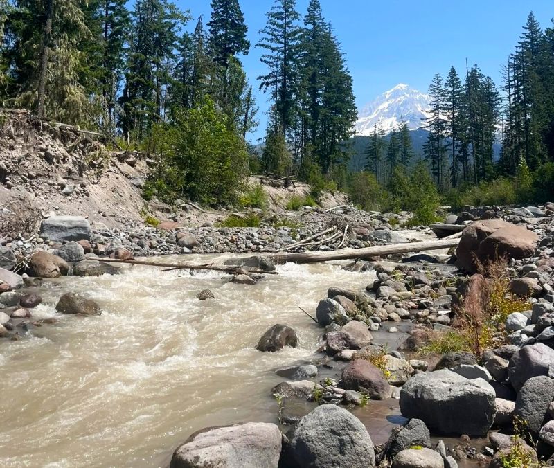
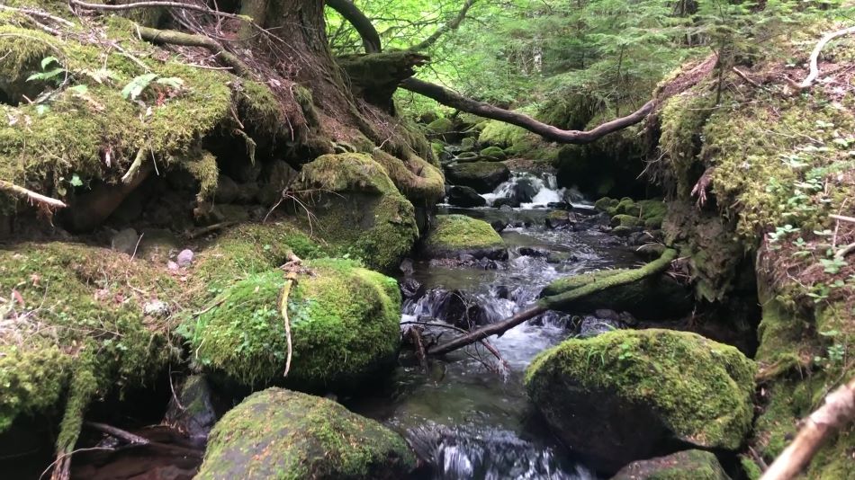
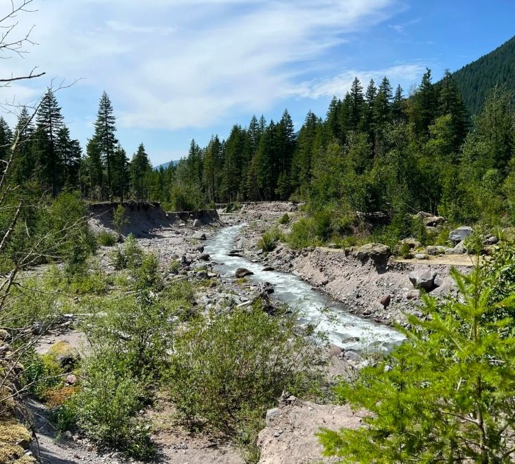
Whichever way you decide, the incline is fairly gradual the entire way, which is nice on the knees. Also, the trail follows the Sandy River most of the way.
Because of the popularity, the trail is usually well maintained and easy to follow.
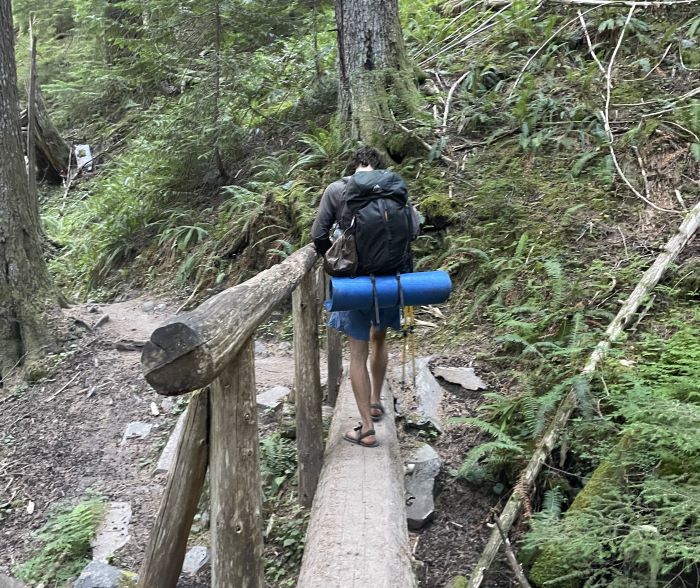
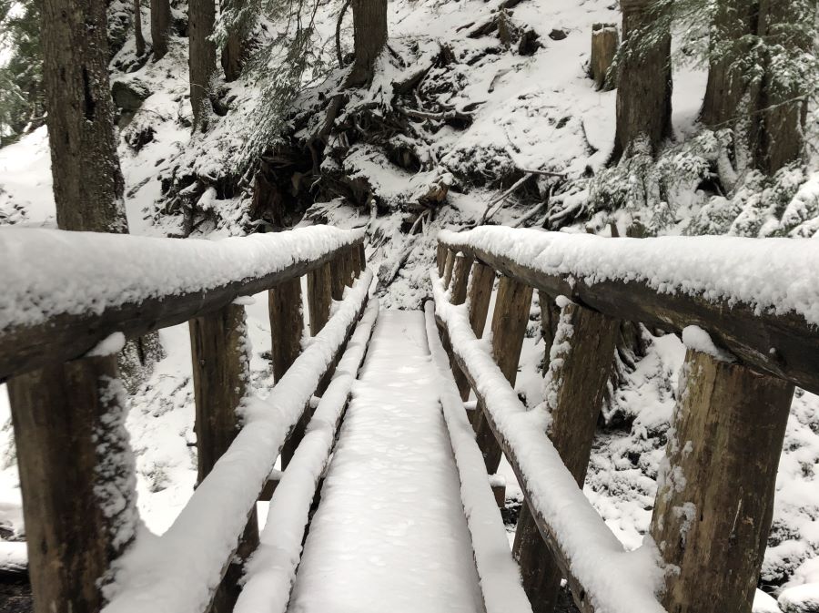
Sandy River Crossing
There is a crossing over the Sandy River (once each way). This crossing used to have a bridge, but as a result of continuous washouts, the USFS has decided to stop reinstalling it.
Therefore, there is no bridge, which can be challenging and dangerous. Spring and early summer typically have the highest flows.
Usually, there are some rocks to hop across or a log spanning the river. However, you may need to get your feet wet. In rare cases, the flow is too high to cross altogether.
We recommend checking the recent trip reports from other people on the All Trails page. This is a popular hike and usually has some helpful information.
You can learn more about how to safely cross rivers in the USFS River Crossing Guide. Also, don’t hesitate to call the ZigZag Ranger Station.
Parking Permit Required
A valid recreation pass is required from May 1 through October 31st. This is either a $5 day use fee or an Annual Northwest Forest Pass.
You can purchase passes online or at the ZigZag Ranger Station, which is also a great place to get any questions you have answered or learn more about the area.
Hiking to Ramona Falls in the Winter
Ramona Falls in the winter can be a beautiful and adventurous experience. At the same time, it can be dangerous and should be approached cautiously.
We’ve hiked to Ramona Falls in the winter and it was stunningly pretty, but also a lot of hard work.
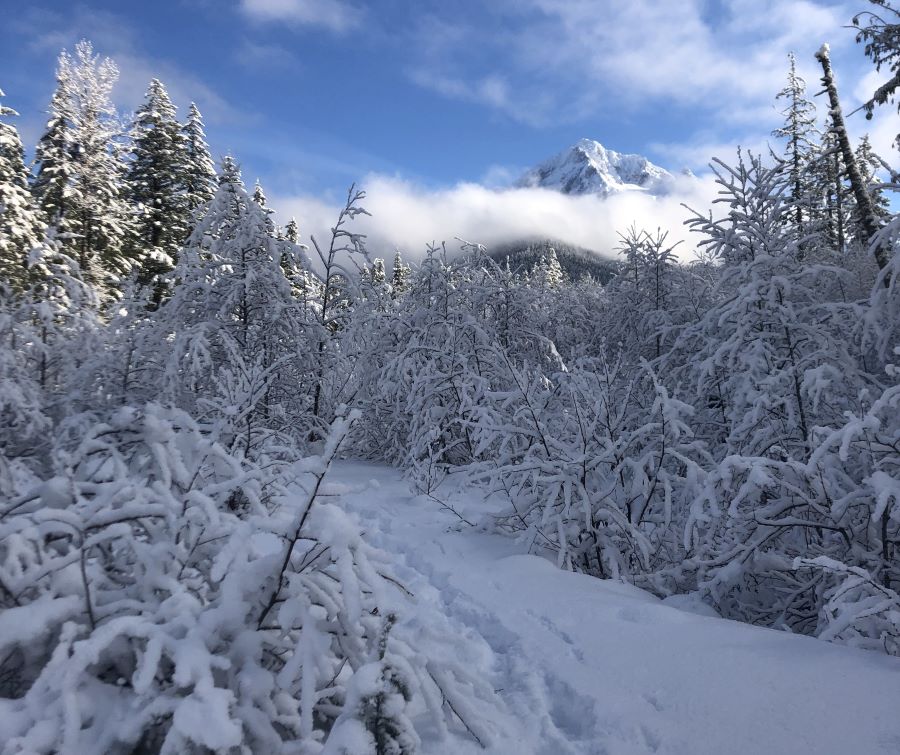
First of all, there is typically lots of snow, which usually warrants snowshoes, unless the trail is already packed down enough.
Second, a seasonal road closure (from December 1 to April 1) adds over 4 miles onto the length of the hike. The road closure is at the start of Muddy Fork Road on the bridge to cross the Sandy River.
Therefore, you should expect to hike about 11-12 miles total which when combined with snow can be brutal.
Check the USFS Roads Table for up-to-date information on road closures. Scroll down to the Zig-Zag Ranger District table and look for the “1825 Muddy Fork Rd”.
Always keep in mind winter road conditions. You can check Trip Check for updates.
A GPS device is highly recommended. In addition, you should certainly hike with a buddy and bring a headlamp in case you are out after dark.
Things to do Near Ramona Falls
There are lots of fun things to do near Ramona Falls, including other hikes, camping, restaurants, lodging, and even rock climbing at French’s Dome.
Other Hikes Nearby
There are tons of hikes around Mt. Hood, including the epic McNeil Point Trail and Paradise Park Trail.
However, the crown jewel of hiking in Mt. Hood area is the 40-mile Timberline Loop Trail, which we highly recommend if you’re looking for a backpacking trail.
Nearby Campgrounds
Ramona Falls is near several campgrounds, including Lost Creek Campground and McNeil Campground. There are also some free dispersed camping in this area.
Restaurants and Lodging
There are lots of restaurants in Zig Zag, Rhododendron, and Government Camp. Some of our favorites are the Rendezvous Grill, Chicali Cantina, and All Forno Ferruzza Pizza.
Ramona Falls FAQ
How long is the hike to Ramona Falls?
The hike to Ramona Falls is approximately 7.1 miles in total. The trail typically takes around 3-4 hours to complete. There is an option for a partial loop so you’ll experience different scenery along the way.
Do you need a parking pass for Ramona Falls?
Yes. A valid recreation pass is required from May 1 through October 31st. This is either a $5 day use fee or an Annual Northwest Forest pass.
How to see Ramona Falls?
1. Drive to the Ramona Falls trailhead.
2. Follow the Sandy River to the river crossing (note that the river crossing can be challenging).
3. Arrive at the loop junction. Choose either the clockwise or counterclockwise direction (we like going counterclockwise).
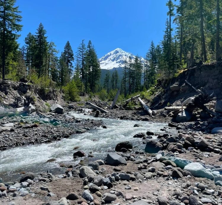
4. Enjoy the lush forest, river views, and glimpses of Mount Hood.
5. Finally, arrive at the falls, where you can view them from a small bridge.
What is the elevation of Ramona Falls?
Ramona Falls is at an elevation of approximately 3,560 feet (1,090 meters).
How much elevation gain is Ramona Falls hike?
The hike to Ramona Falls involves an elevation gain of about 1,000 feet, but the incline is fairly gradual.
Is Ramona Falls a hard hike?
Ramona Falls is considered a moderate hike. It’s suitable for most hikers but be prepared for some rocky sections and the river crossing. Proper footwear and caution are essential, especially during wet seasons.
Conclusion
We hope you feel ready to tackle the Ramona Falls Oregon hike! Please leave a comment if you have any questions.
If you’re interested in learning more things to do nearby, check out our other articles about Mt. Hood and the Columbia River Gorge. Happy adventuring!
Also, subscribe to our YouTube and follow us on Instagram to level up your adventures in the Pacific Northwest. Happy roaming!
As always, be sure to leave no trace when you visit to preserve this special place for future visitors.
")
 +Map")


")
")