")
These incredible Bend Oregon winter hikes are a great way to get outside during the cold winter months in the high desert.
As central Oregon residents, we love these winter hikes near Bend and are excited to share them with you.
We’ve gathered our local knowledge here in this article to help you enjoy the best winter hikes Bend Oregon has to offer.
So pack your cozy winter hiking clothes and let’s hit the trail!
Winter Hikes in Bend Oregon: Overview
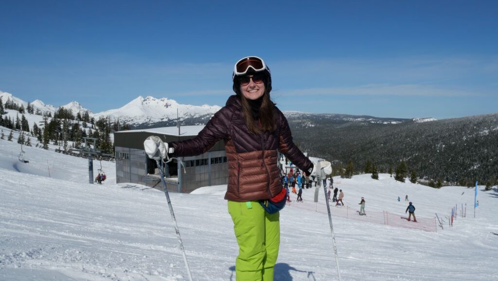
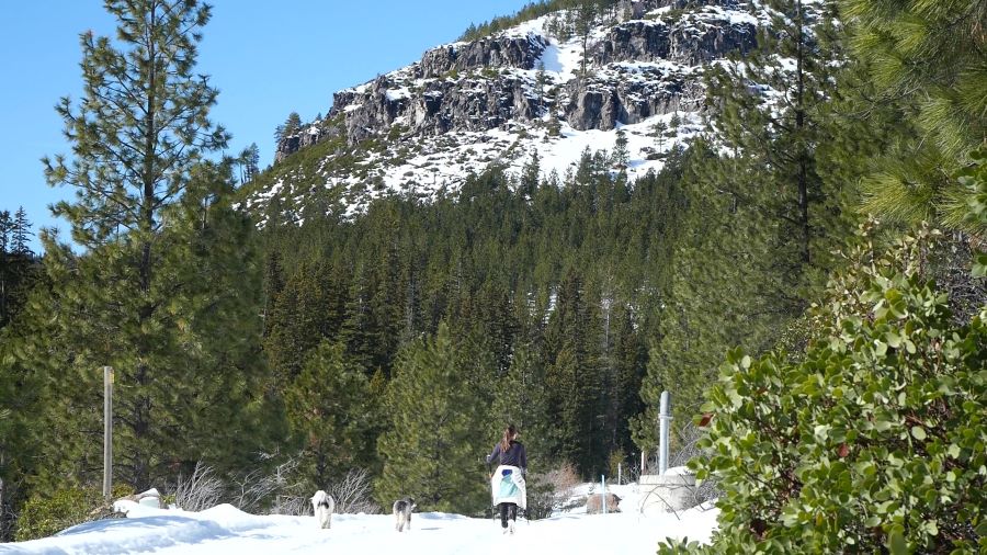
When most people think of winter in Bend Oregon they often think of ski resorts like Mt. Bachelor, and winter activities at sno-parks near Bend like cross-country skiing and snowshoeing.
However, what many people don’t realize is that winter can be a great time for hiking near Bend!
Of course, many of the best hikes near Bend are not accessible during the winter months because they are buried in snow.
Still, there are lots of Bend Oregon winter hikes to be enjoyed, whether they have snow on them or not!
The cold temperatures, snowy landscapes, and lack of crowds can make for an epic winter hiking adventure near Bend.
Keep in mind: For most of the winter, there is no snow on the ground in and near Bend. That said, if you go up 500 to 1,000 feet in elevation, there will typically be snow all winter.
Bend Winter Hikes Map
Use this interactive map of Bend Oregon winter hikes to get your bearings. You can expand the map to open it in a new window.
The table below shows an overview of the Bend winter hikes mentioned in this article.
| Winter Hike Near Bend | Trailhead Distance from Bend | Trailhead Elevation | Typically Snow on the Trail? | Best for |
| Deschutes River Trail | Variable. Less than 5 miles. | 3,400 – 3,800 feet | No | Casual hike in or near town. Variety of trails. |
| Smith Rock State Park | 26 miles | 2,800 feet | No | Epic rocky landscape. Mountain views. Variety of trails. |
| Shevlin Park | 4 miles | 3,700 feet | No | Peaceful and forested walk in the park. |
| Pilot Butte | In town | 3,700 feet | No | Great views of Bend and surrounding landscape. |
| Oregon Badlands Wilderness | 17 miles | 3,700 feet | No | Isolated desert landscape with crowds. |
| Skyliner Sno-Park | 11 miles | 4,800 feet | Yes | Snow winter wonderland with a waterfall. |
| Lava Butte | 11 miles | 4,700 feet | Yes | Nice vantage point with unique lava fields. |
| Ten Mile Sno-Park to Paulina Lake | 33 miles | 5,600 feet | Yes | Snowy winter wonderland with a waterfall and lake. |
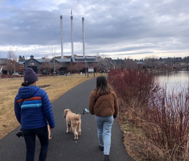
Deschutes River Trail
The Deschutes River Trail is not necessarily a single trail, but rather a group of individual trails that follow the iconic Deschutes River.
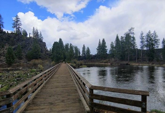
In general, there are three main parts of the Deschutes River Trail and dozens of individual trailheads.
| Deschutes River Trail Section | Overview | Trailheads we like |
| Upstream of Bend (southwest) | Natural river-side trails close to town. | Meadow Day Use Area Lava Island TrailheadDillon Falls Trailhead |
| In Bend | Urban river-side trails in town. Close to cafes, restaurants, and shops. | Riverbend ParkMcKay Park |
| Downstream of Bend (north) | Natural river-side trails close to town. | Riley Ranch Nature Reserve Tumalo State Park |
Local tip: We love the Deschutes River Trail for a quick and accessible winter hike from Bend.
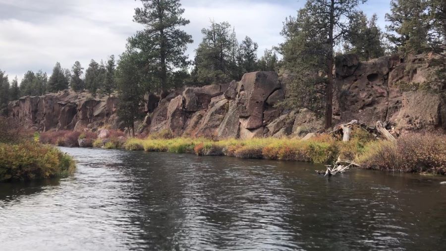
We like to park at Farewell Bend Park or Riverbend Park and head upstream. We also like the Meadow Day Use Area and Riley Ranch Nature Reserve.
Learn more in our full article about the Deschutes River Trail.
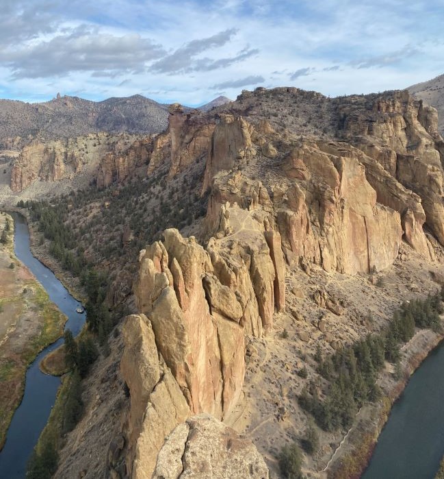
Smith Rock State Park
Considered by many to be the most iconic state park in central Oregon, Smith Rock State Park is undeniably one of the best places for winter hiking near Bend.
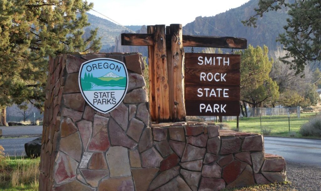
Located about 26 miles north of Bend, it typically takes about 35 minutes to drive to Smith Rock from Bend, which is totally reasonable for a day hike.
In our opinion, if you only have time to do one winter hike near Bend, make it this one!
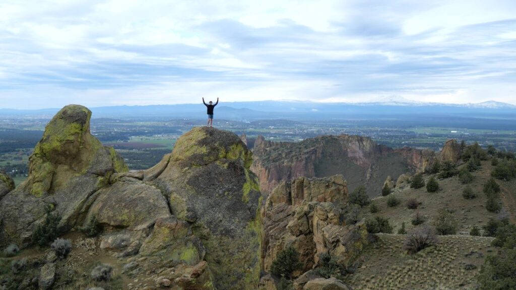
The variety of trail options, diverse views, and impressive rock formations make this one of our favorite places in central Oregon.

Local tip: We recommend the Misery Ridge Loop, which is less than 4 miles but has substantial elevation gain. For a longer hike that circles the entire park, check out the Burma Road Loop.
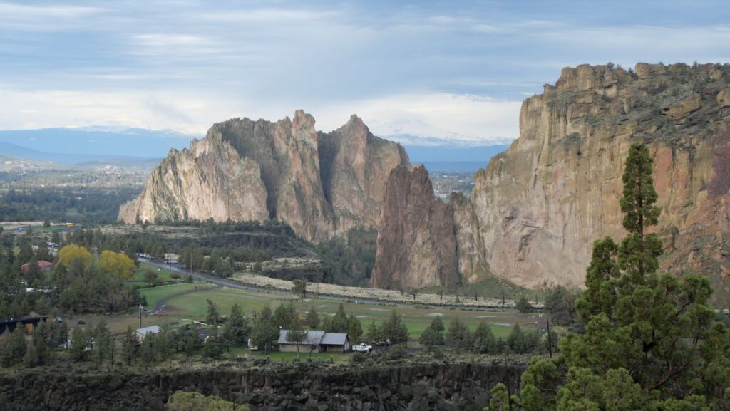
Also, all of the roads are highly trafficked and there are no dirt roads, so if there is snow on the ground it likely won’t impact your drive too much.
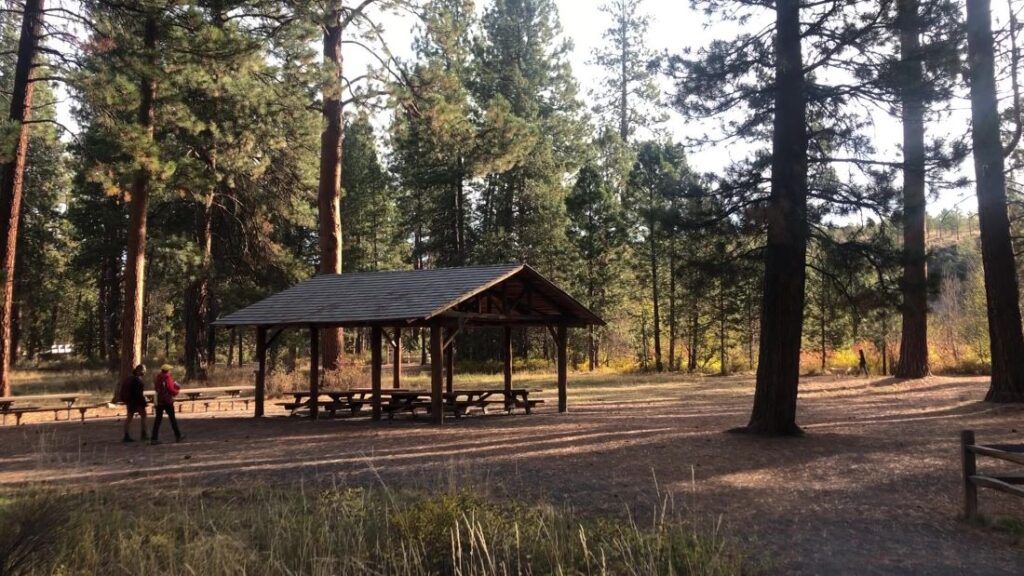
Shevlin Park
Shevlin Park is one of our go-to Bend Oregon winter hikes. It’s a short drive from downtown Bend and never feels crowded.
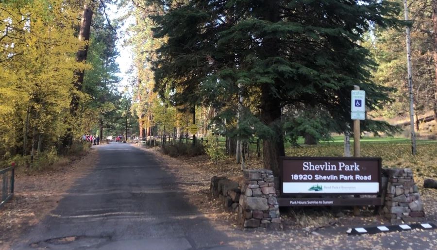
There are a variety of trails with tons of loop options. The trails are mostly forested and parallel the frigid Tumalo Creek.
You can do as long or as short of a hike as you’d like. Also, there are covered picnic tables which can be a great place to enjoy that warm beverage in your backpack.
Local tip: Come back to Shevlin Park during fall in Bend for some of the best fall foliage in central Oregon.
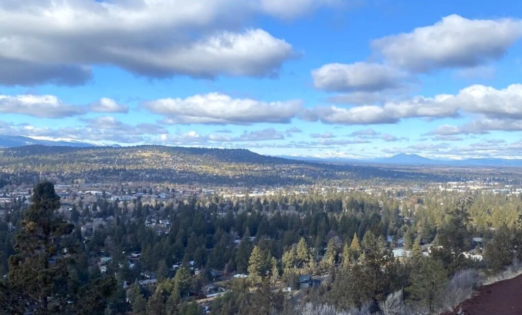
Pilot Butte
Pilot Butte is an iconic butte (a big hill) located on the east side of Bend. In the summer, you can drive to the top. However, the road is closed in the winter.
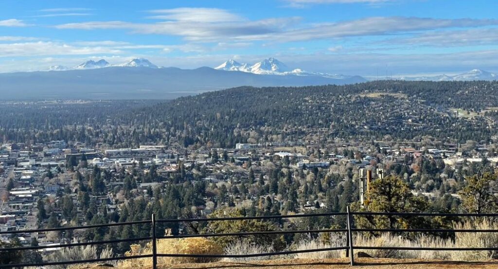
Therefore, to access the expansive 360 degree views from the top, you must hike!
The hiking trail to the top of Pilot Butte is about 2 miles and has about 450 feet of elevation gain.
Even in the cold winter months, this hill is sure to get your blood pumping. The amazing views make the effort well worth it though!
Local tip: This is one of the best places in Bend to watch the sunrise and sunset! Also, check out Backporch Coffee Roasters (eastside location) or The Dough Nut Bakery for tasty treats.
Oregon Badlands Wilderness
Sprawling across a wide expanse of high desert landscape, visiting the Oregon Badlands Wilderness is usually an isolating and memorable experience, especially during the winter months.
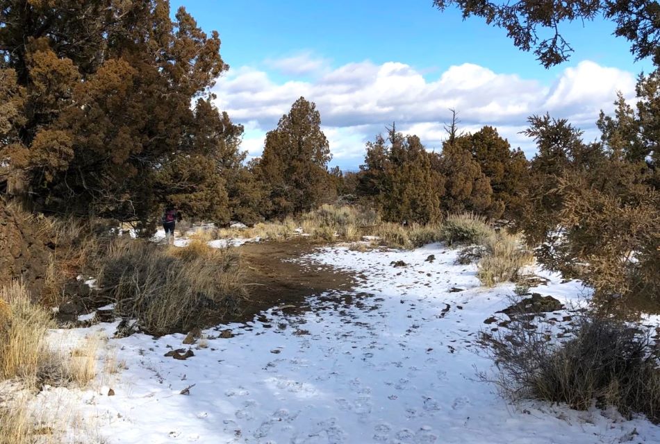
Located about 17 miles southeast of Bend, there are a variety of trail options that offer access to the Oregon Badlands Wilderness.
We recommend heading to one of the two main trailheads: Flatiron Rock Trailhead or Badlands Rock Trailhead.
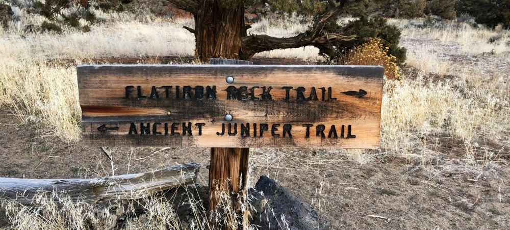
One good option is the Ancient Juniper Trail, which is just over 3 miles with minimal elevation gain.
Overall, the lack of shade and sandy soil make this area relatively warm on a sunny winter day.
Local tip: Across Highway 20 is the Horse Ridge Trailhead, which has a few trails that climb higher in elevation and provide some nice views.
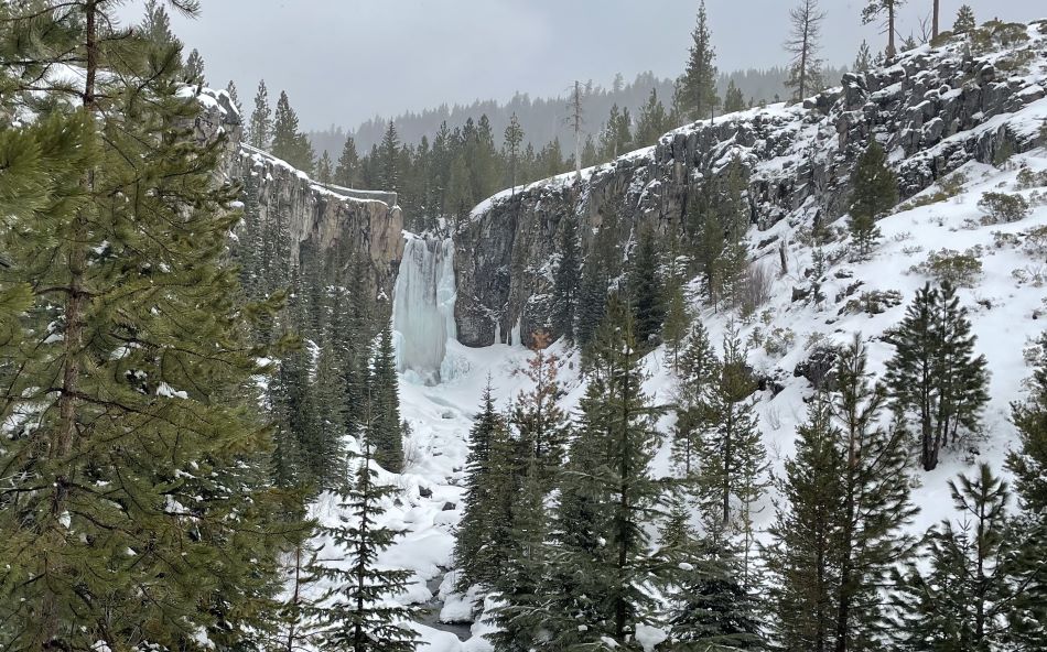
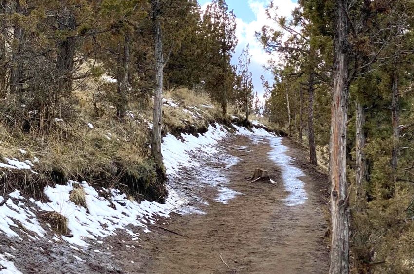
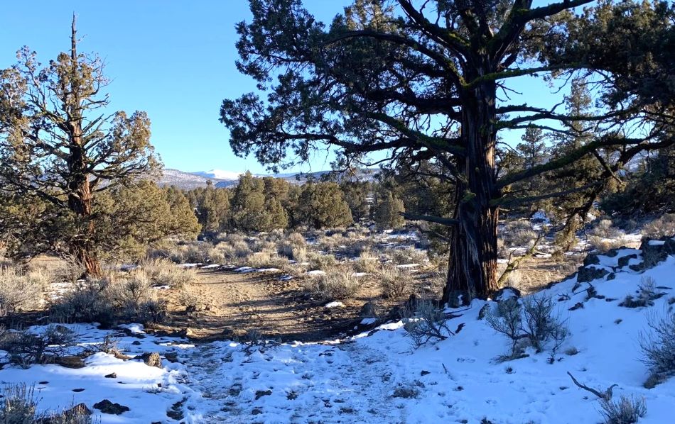
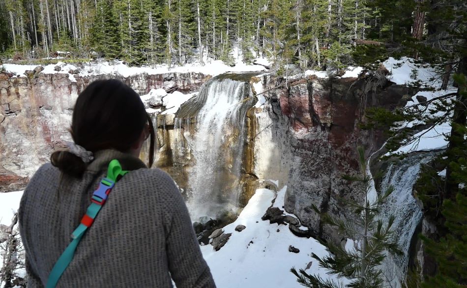
Skyliner Sno-Park
Perhaps our favorite sno-park near Bend, Skyliner Sno-Park is mostly known for snowshoeing and cross-country skiing.
It is covered in snow most of the winter, but is still a popular winter hike near Bend due to the large amount of traffic that packs the snow down.
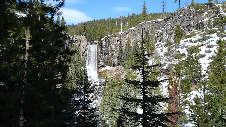
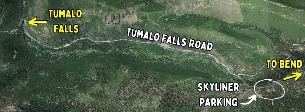
Park at the Skyliner Sno-Park Trailhead and take the Tumalo Falls Road (which is closed to cars during winter) for about 3 miles until you reach the beautiful Tumalo Falls.
This is one of our favorite routes for cross-country skiing near Bend but it can still be done as a winter hike if there has not been much fresh snow recently.
Lava Butte
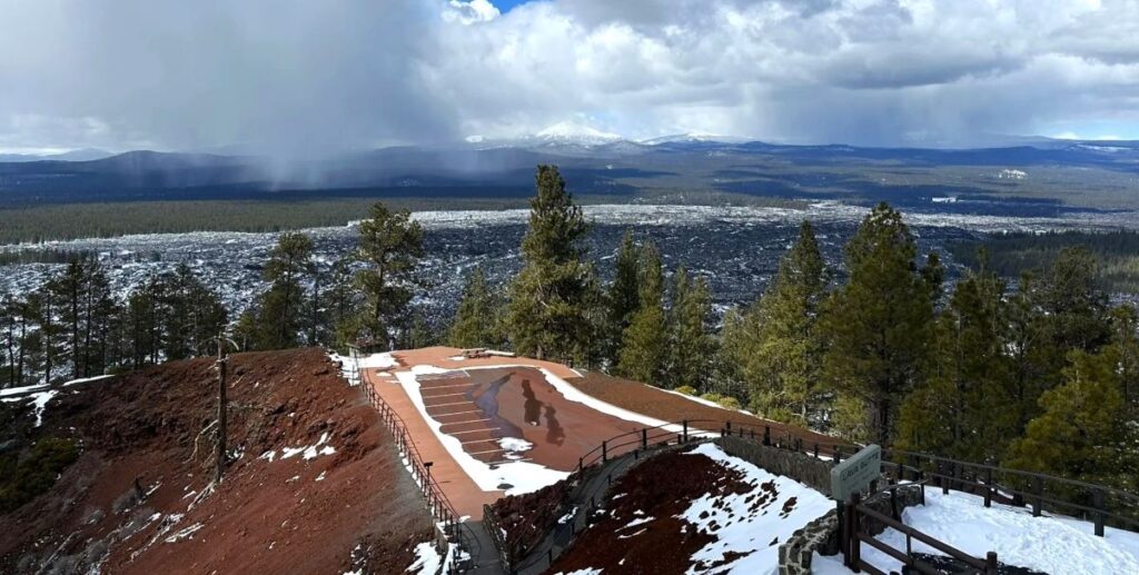
Another iconic butte near Bend, Lava Butte is part of the beautiful Newberry National Volcanic Monument and is about 11 miles south of Bend.
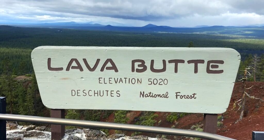
Similar to Pilot Butte, there is a road to the top of the butte but it is closed in the winter. Therefore, your only option to access the stunning views from the top is to hike!
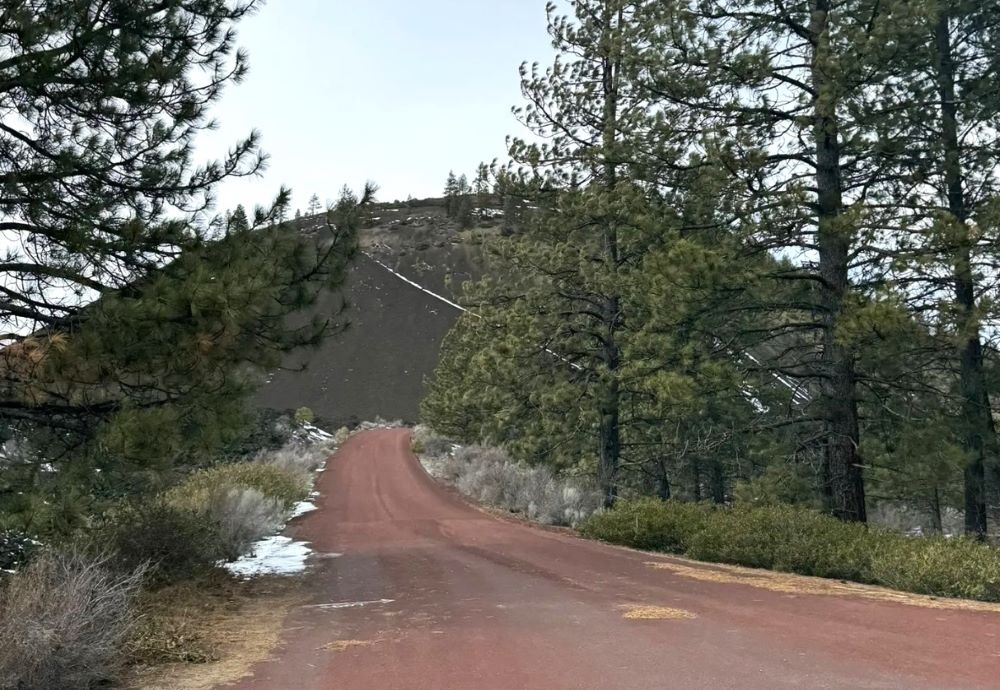
Park at the Lava Lands Visitor Center (which is closed in the winter) and follow NF 100 to the top of the Lava Butte. Overall, the hike is about 4 miles with nearly 600 feet of elevation gain.
Keep in mind: There is a good chance that snow will be on the ground, especially as you climb higher on the butte.
Local tip: Stop by the High Desert Museum to make it a full day of exploring! This is one of the best natural history museums in Oregon.
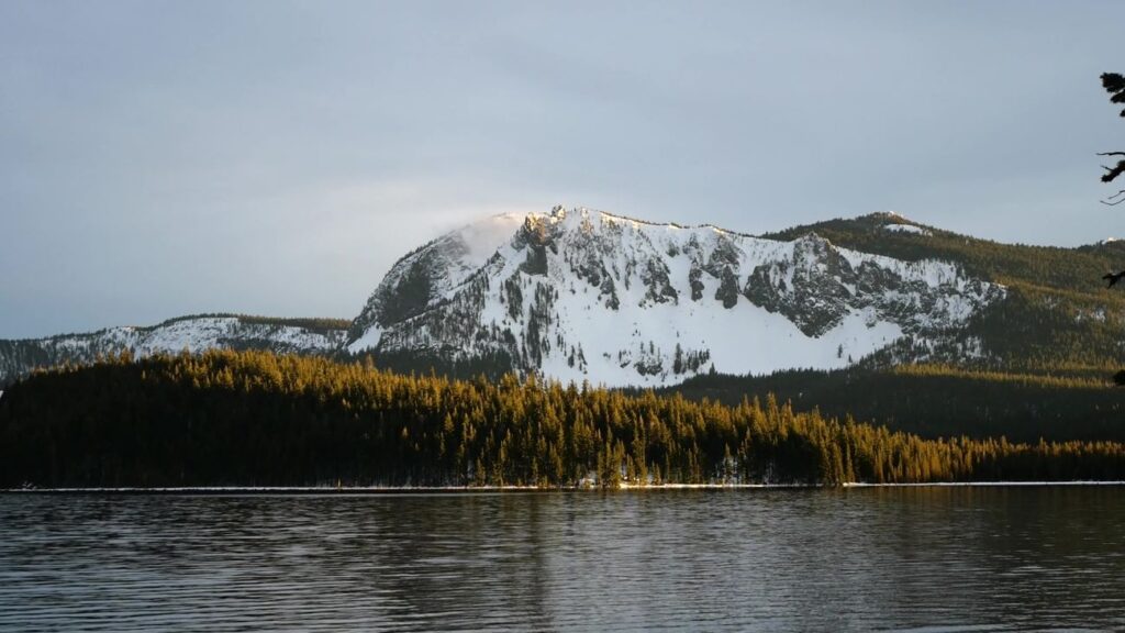
Ten Mile Sno-Park to Paulina Lake
If you want a snowy and adventurous hike in a winter wonderland, check out this route from Ten Mile Sno-Park to Paulina Lake.
In the summer, Paulina Lake, located in the Newberry National Volcanic Monument, is one of our favorite lakes near Bend for camping, swimming, hiking, and paddleboarding.
However, in the winter this area transforms into a winter wonderland. As a result of the high elevation, there will almost certainly be snow on the ground during winter and the conditions vary.
In fact, this trail is actually a snowshoe and cross-country ski trail, but we like to hike it when it hasn’t snowed in a while and the snow is packed down.
If it has snowed recently, we recommend snowshoeing or cross-country skiing this trail rather than hiking it.
Even when the snow is packed down, this can be a tough hike. Also, if the snow is not packed down, please respect any existing cross-country ski tracks and do not walk on them.
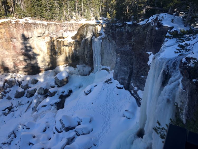
The main draw is the stunning Paulina Falls and Paulina Lake. As a whole, this trail is about 6 miles, but the snow can make it feel a lot longer.
Be aware: You do need a Sno-Park Permit to park at Ten Mile Sno-Park and there can be a lot of snowmobile noise.
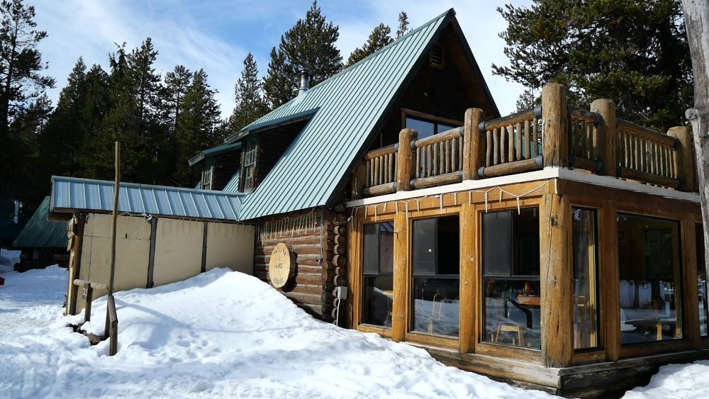
Local tip: Stop by the Paulina Lake Lodge for lunch with a lakeside view. Be sure to check their hours.
Conclusion
We hope you enjoy some of these epic winter hikes Bend Oregon has to offer!
At Rooted and Roaming, we are dedicated to providing you with accurate, concise, and informative information to help you level up your adventures in the Pacific Northwest.
We have tons of other articles about central Oregon and winter in Bend.
Also, subscribe to our YouTube and follow us on Instagram for more inspiration for exploring the PNW. Happy roaming!
")
 +Map")


")
")