")
In this article, we’re on a mission to help you find the best hikes near Bend!
The truth is, hiking Bend Oregon is beautiful, accessible, and diverse. In fact, there are hundreds of day hikes near Bend that are worth exploring.
That said, these central Oregon hiking trails stand out from the rest. The incredible scenery, accessibility, and wow-factor are sure to leave you awestruck.
As avid central Oregon hikers, we love these hikes near Bend and want to help people like you experience their wonder for yourself.
Therefore, we’ve gathered our local knowledge of our favorite Bend Oregon hikes in this article to point you in the right direction and save you time.
So, pack some snacks and lace up your shoes as we explore the best places to hike in central Oregon.
This post may contain affiliate links. We may earn a commission when you purchase products mentioned in this post.
Hiking Central Oregon: Overview
As we said, there really are hundreds of hiking trails near Bend, but these places to hike near bend Oregon are the best of the best.
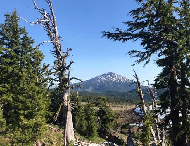
Central Oregon hiking is diverse, encompassing crisp alpine lakes, sweeping mountain views, and unique high desert landscapes.
From short strolls to full-on treks, this list of hikes near Bend is diverse to represent all types of scenery and difficulties.
As you do more hikes in central Oregon, you’ll notice the strong influence of elevation and time of year.
Generally, hikes near Bend are between 3,000 and 8,000 feet of elevation. As a result, many of the higher elevation central Oregon hiking trails can only be hiked in summer and early fall.
Keep in mind: In this article, we focus on hikes that you can do in the summer. If you’re visiting Bend during winter, check out our full guide to winter hikes near Bend.
For a high-level overview, the table below contains all of the places to hike in central Oregon mentioned in this article.
| Day Hike Near Bend | Distance From Bend | Difficulty | Known For |
| Deschutes River Trail | 5 – 10 min | Easy | Variety of riverside trails near town. |
| Pilot Butte | 5 – 10 min | Moderate | Great views of Bend and mountains. |
| Shevlin Park | 5 – 10 min | Easy | Flat and forested trails near town. |
| Tumalo Falls | 25 min | Easy | Very short hike to stunning waterfall. |
| Tumalo Mountain | 30 min | Moderate | Short steep hike with epic views. |
| Green Lakes Trail | 35 min | Hard | Alpine lakes with mountain views. |
| South Sister Trail | 35 min | Hard | Long climb with rewarding views. |
| Smith Rock State Park | 45 min | Variable | Impressive rock formations Variety of trails. |
| Ray Atkeson Memorial Trail | 45 min | Easy | Amazing lakeside trail with mountain views. |
| No Name Lake | Variable | Hard | Incredible alpine lake and views. |
| Paulina Peak Trail | 50 min | Moderate | Excellent loop around a large lake. |
| Black Crater Trail | 1 hr | Moderate | Rugged trail with sweeping views. |
| Canyon Creek Meadows Loop | 1 hr 20 min | Moderate | Wildflower meadows and views of Three Fingered Jack. |
| Painted Hills | 2 hrs | Easy | Otherworldly and colorful hills. |
| Blue Basin Overlook | 2 hrs 30 min | Easy | Unique blue green rock formations. |
Best Hikes in Central Oregon: Map
Use this interactive map we made to get your bearings. You can also expand it to open in a new window.
Best Day Hikes Near Bend: Within a 30 Minute Drive
If you’re short on time or don’t want to drive far, these hikes near Bend are nearby and easy to access.
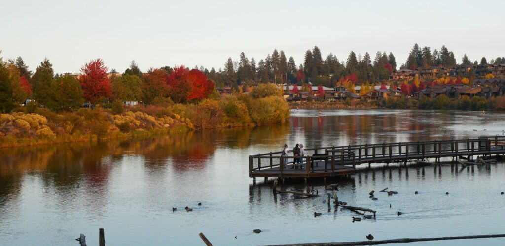
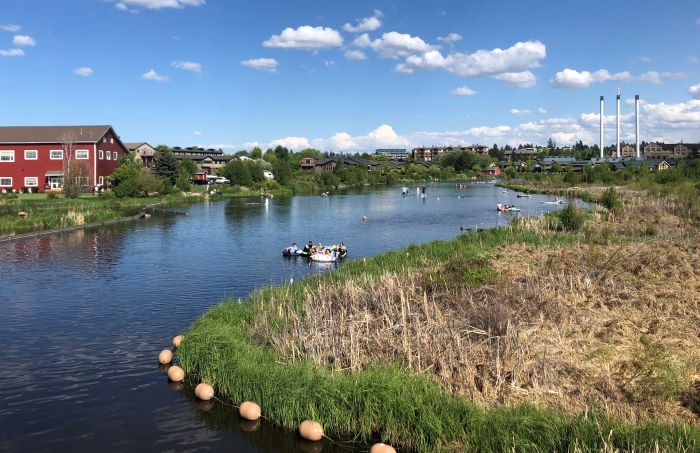
Deschutes River Trail – Accessible and Beautiful
The Deschutes River Trail follows the iconic Deschutes River and is made up of several independent sections within Bend and outside of the town.
Distance From Bend: Depends on the section
Season: Year-round
Permits/Fees: None
The most urban section is the Old Mill Reach, which starts in the Old Mill District.
This part of the Deschutes River Trail is a great way to see some unique Bend spots such as people floating the Deschutes River and surfing the river wave.
For a more natural experience, there are sections of the Deschutes River Trail upstream (southwest) of Bend and downstream (north) of Bend.
To the southwest, check out trailheads like the Meadow Day Use Area, Lava Island trailhead, Big Eddy Trailhead, and more. There is a continuous trail that connects all of these trailheads.
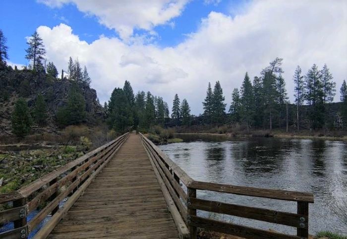
To the north, check out Tumalo State Park and Riley Ranch Nature Reserve, two great places to access natural sections of the Deschutes River Trail.
Learn more in our full guide to the Deschutes River Trail.
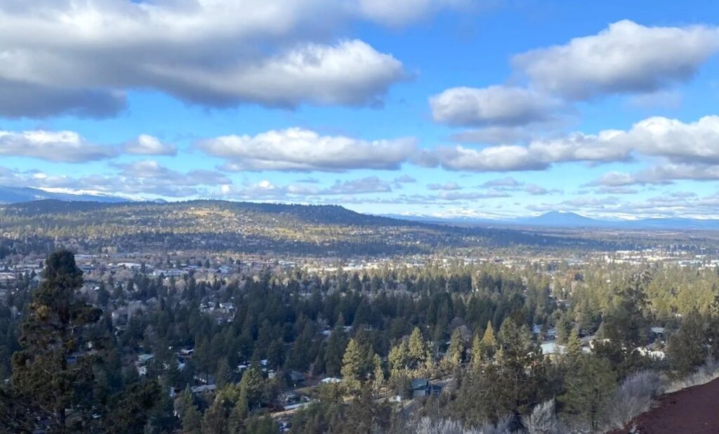
Pilot Butte – Sweeping Views of Bend
Pilot Butte is a steep but short hike with 360-degree views of Bend and the mountains.
Distance From Bend: In Bend
Difficulty: Easy
Length: 2 miles
Elevation Gain: 500 feet
Season: Year-round
Permits/Fees: None
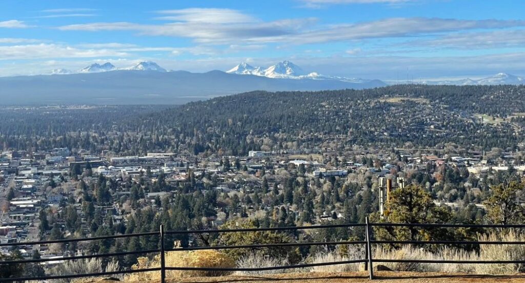
We recommend this hike in Bend for its easy access and amazing views. The views from Pilot Butte are a great way to get your bearings on the central Oregon landscape.
Keep in mind: You can also drive to the top of Pilot Butte during the warmer months when the road is open.
Local tip: This is one of our favorite sunrise and sunset spots in Bend!
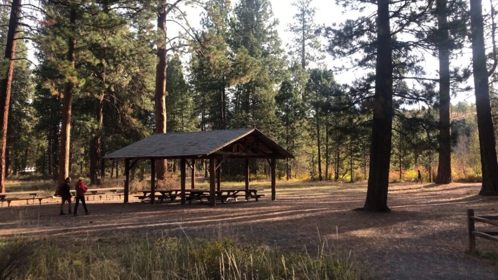
Shevlin Park – Creekside Trails in a Forested Park
Shevlin Park is another great natural space near Bend, which offers relaxing trails along a pleasant creek, without the need for a long drive.
Distance From Bend: 5 – 10 minutes
Season: Year round
Permits/Fees: None
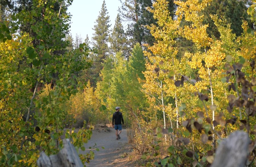
Hikers can choose from multiple routes, but all the trails are relatively flat and parallel the creek. Also, most of the trails are shaded, making it a great spot on a hot day.
Shevlin Park is a great place for a picnic. There is a covered picnic area and also picnic tables alongside Tumalo Creek.
There are also lots of additional trails outside of the park if you want to add more miles.
Local tip: Shevlin Park is one of our favorite places to see leaves changing colors during fall in Bend.
Tumalo Falls – Easy Hike to an Impressive Waterfall
Tumalo Falls is a captivating waterfall along Tumalo Creek, a tributary to the mighty Deschutes River. In fact, Tumalo Falls is one of the best waterfalls near Bend.
Distance From Bend: 14 miles, 25 minutes
Season: Year-round, snow on the ground during winter
Permits/Fees: Northwest Forest Pass
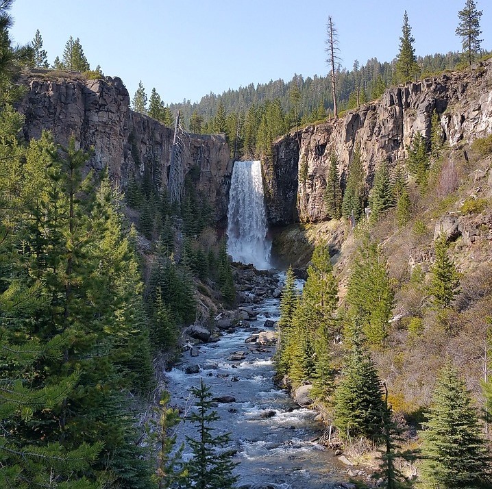
The primary attraction is the dazzling waterfall itself, which is nearly 100 feet high and cascades over the edge of a rugged canyon.
The falls are very accessible as they are super close to the trailhead. Just a short walk takes you to the edge of the falls.
Fortunately, you can keep hiking as long as you want, because there are a variety of trails in the area. We recommend the Tumalo Falls Loop as a pleasant medium-length hike.
Local Tip: The hiking lot at Tumalo Falls can be crowded during summer weekends. Get there early or later in the afternoon.
Keep in mind: You can also do this hike in the winter, but the road is closed which adds 2.5 miles to the hike. Learn more in our full article about Skyliner Sno Park.
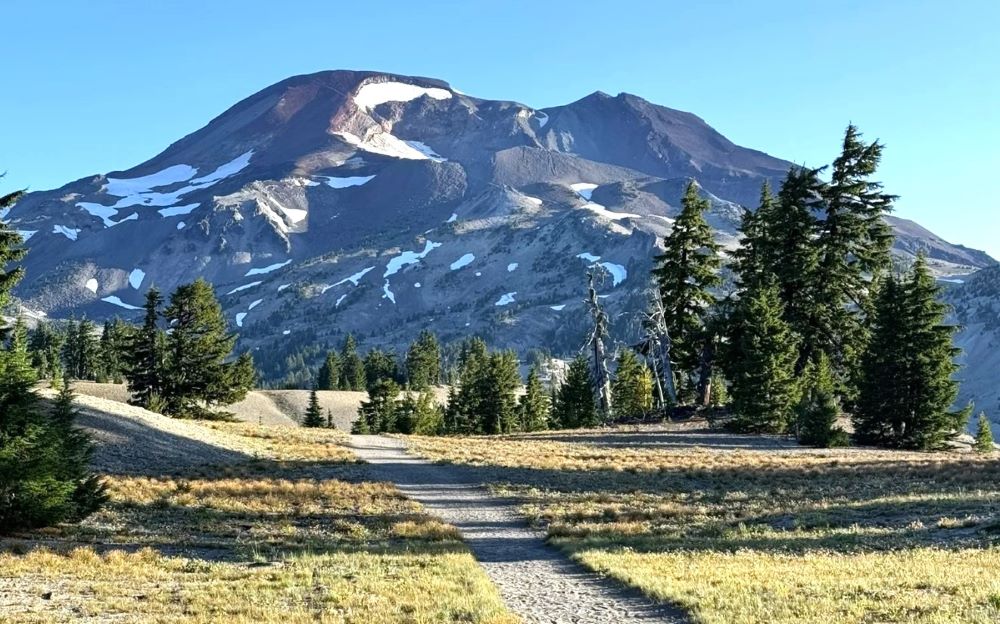
Tumalo Mountain – Expansive Mountain Views
One of the more underrated hikes near Bend, the trail to the top of Tumalo Mountain is fairly steep, but worth the incredible mountain views from the top.
Distance From Bend: 21 miles, 30 minutes
Difficulty: Moderate
Length: 4 miles
Elevation Gain: 1,400 feet
Season: July through October
Permits/Fees: No
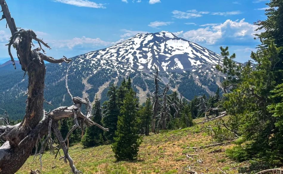
Hikers are granted up close and personal views of Mt. Bachelor, South Sister, and Broken Top, three of the most iconic central Oregon peaks.
Local tip: This is a great place to watch the sunset or sunrise because of the relatively close proximity to Bend.
Hikes Near Bend: 30 Minutes to 1 Hour Drive
If you can commit to a bit further drive, you are able to access a huge amount of central Oregon hiking trails. We promise the drive is worth it!
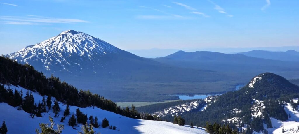
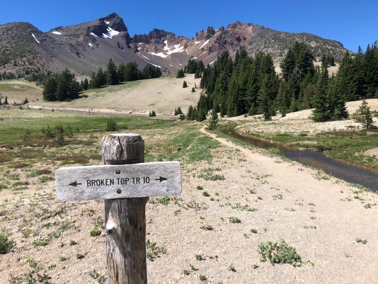
Green Lakes Trail – Alpine Lakes with Mountain Views
Green Lakes Trail is moderately difficult and very beautiful out-and-back hike near Bend with up-close mountain views of South Sister and Broken Top.
Distance From Bend: 25 miles, 35 minutes
Difficulty: Moderate
Length: 9.2 miles
Elevation Gain: 1,200 feet
Season: July to October
Permits/Fees: Yes, Central Oregon Cascades Permit
Starting at the Green Lakes/Soda Creek Trailhead and ending at the scenic Green Lakes, this trail follows Fall Creek most of the way and also has some small waterfalls.
Overall, this is a solid moderate hike near Bend that provides a great mix of creek-side trail, alpine lakes, and mountain views.
Local tip: To make this a 12.5-mile loop, take the Broken Top Trail to the Soda Creek Trail to the parking lot. Here’s the route on All Trails.
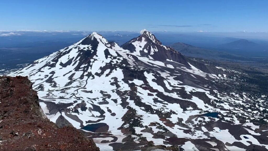
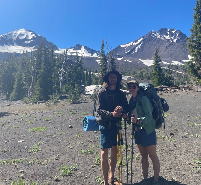
South Sister Trail – A Challenging Climb to Crazy Views
South Sister Trail is known for its grueling ascent up South Sister Mountain, where you certainly have to earn some of the best views in central Oregon.
Distance From Bend: 24 miles
Difficulty: Hard
Length: 12 miles
Elevation Gain: 3,600 feet
Season: July to Mid-October (weather depending)
Permits/Fees: Yes, Central Cascades Wilderness Permit
This climb is no joke, with a long and exposed trail to summit the third tallest mountain in Oregon (at over 10,000 feet of elevation).
Hikers set off at Devil’s Lake Trailhead, cross the Cascade Lakes Scenic Byway, and start the climb.
The first couple miles are forested before you break out into the open and are greeted with nice views of the surrounding mountains. However, to achieve the iconic 360-degree vantage of central Oregon, you must make the summit!
Be aware of snow on the ground for most of July and October. August and September typically don’t have snow on the ground. That said, weather can be bad during any time of the year.
Local Tip: There is a lot of scree (small rocks) on this trail that will get into your shoes. If you have them, it is recommended to wear trail gaiters. Also, we highly recommend hiking poles.
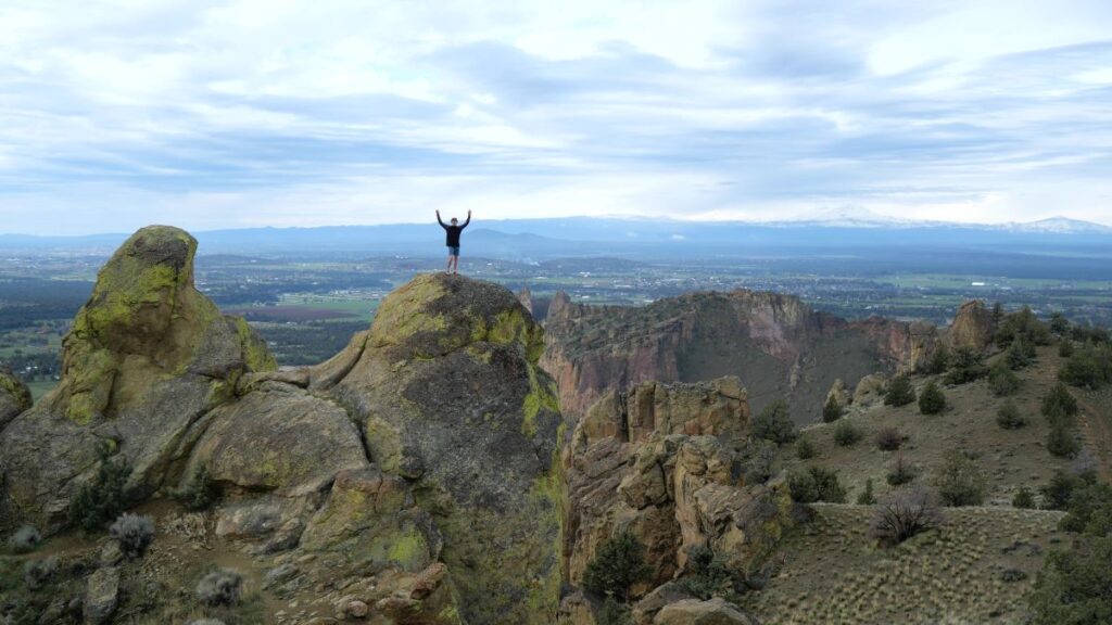
Smith Rock State Park – Incredible Rock Formations
Smith Rock State Park is an iconic central Oregon landmark that has impressive rock formations, a variety of hiking trails, and memorable viewpoints.
Distance From Bend: 26 miles, 45 minutes
Season: Year-round
Permits/Fees: A $5 day pass (can purchase onsite) or Oregon State Parks annual pass
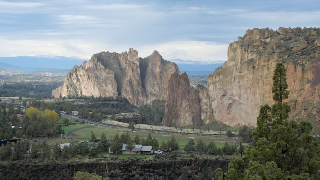
The main draw of Smith Rock is the incredible towering rock formations and variety of views within a relatively small area.
In addition, Smith Rock has a variety of hikes with a diversity of lengths and intensity.

Perhaps the most popular hike is the Misery Ridge Loop, which is one of the most rewarding and popular hikes in central Oregon. We also like the Burma Loop Road, which takes you around the entire park.
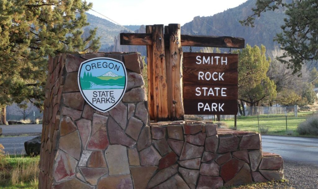
Local Tip: Smith Rock is often crowded during weekends. Be sure to get there before 9:00 for the best chance of a parking spot. Also, grab some huckleberry ice cream at the shop on your way out of the park!
In our opinion, it’s a must visit destination. Check out our full article and guide video to Smith Rock.
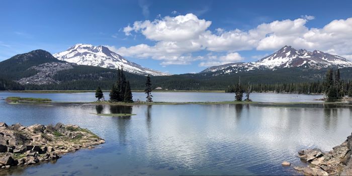
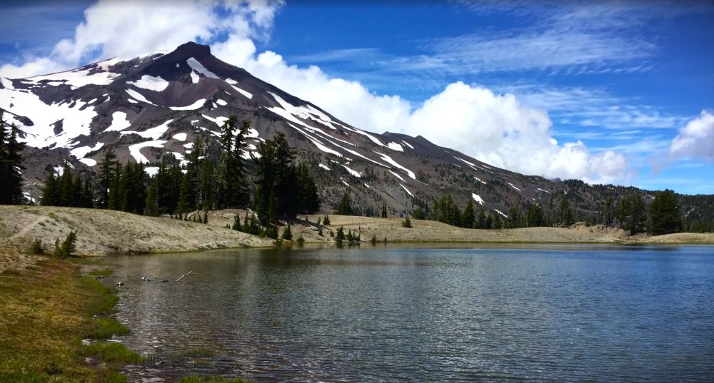
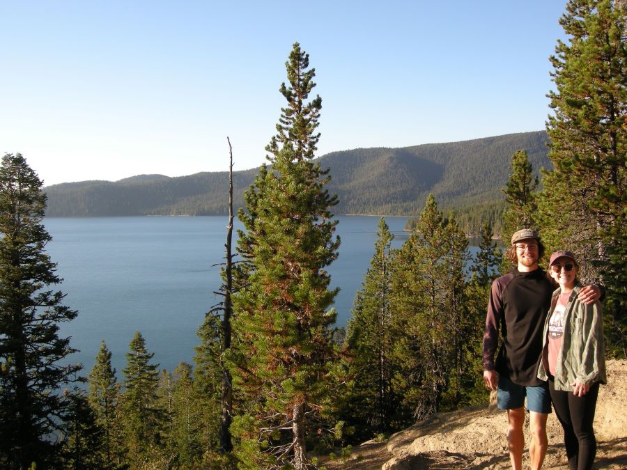
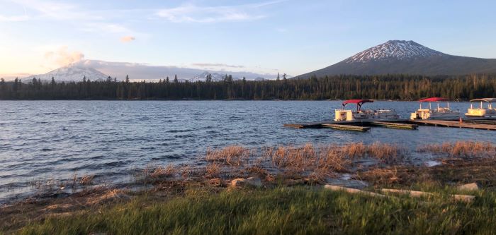
Ray Atkeson Memorial Trail – Iconic Lake and Mountain Views
The Ray Atkeson Memorial Trail is without a doubt one of the best easy hikes near Bend. In fact, this trail is in our top 5 of all central Oregon hikes.
Distance from Bend: 27 miles, 45 minutes
Difficulty: Easy
Length: 2.4 miles
Elevation Gain: Minimal
Season: June through October
Permits/Fees: None
The trail winds through classic high desert forest and unique lava rock formations. However, the best part is when the trail borders Sparks Lake and offers amazing views of the lake and mountains behind.
This iconic Bend trail starts at the Sparks Lake Day Use Area, which is also a great place to swim or take in the views.
Local tip: If you have time, we recommend doing the entire loop counterclockwise. This way, you can start by walking through lava flows and end with magnificent views of the lake and mountains.
If you are short on time. Do just the lakeside section as it offers some of the best views in central Oregon.
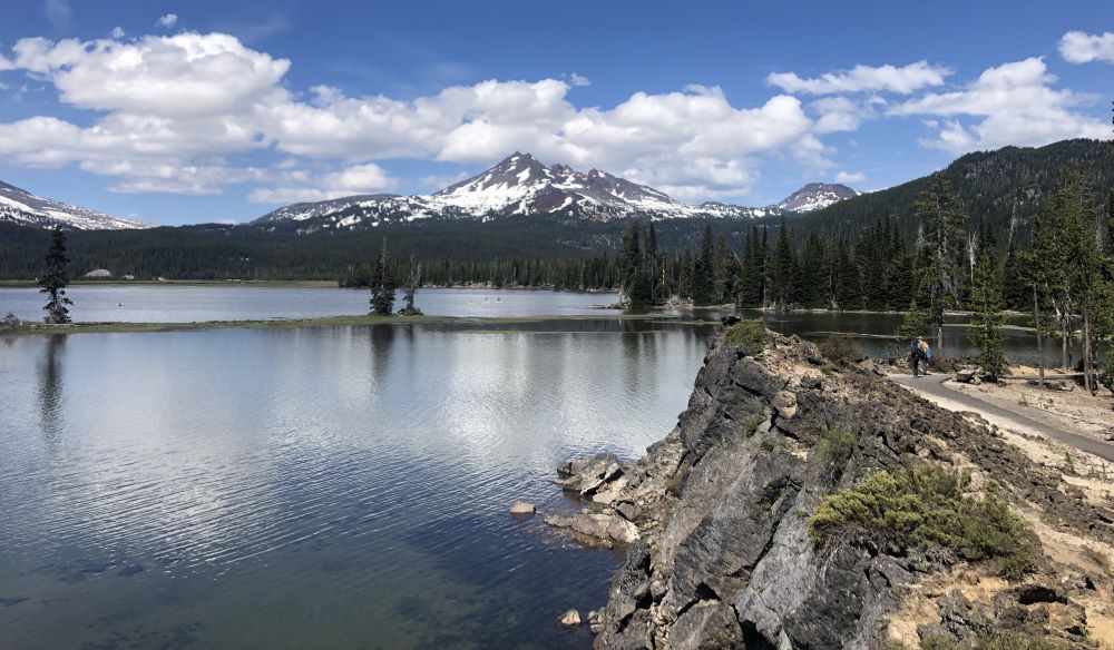
Local tip: This is one of the best places for paddleboarding and kayaking near Bend, so bring your own or rent in town!
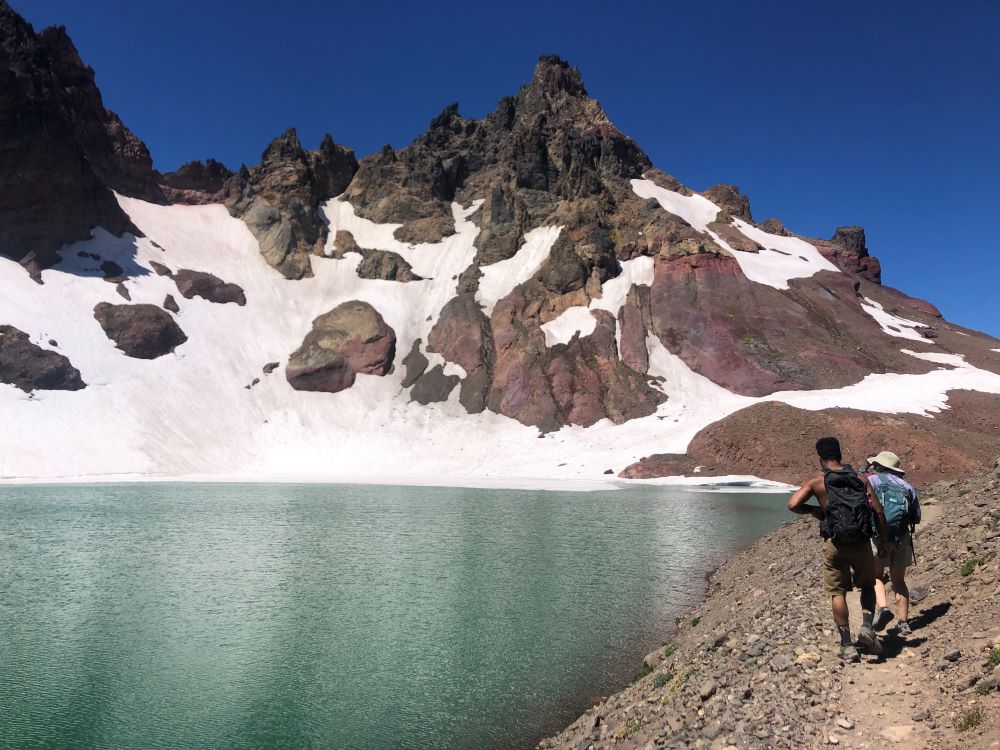
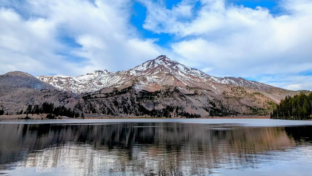
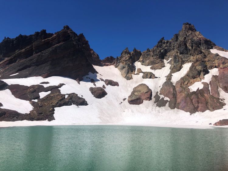
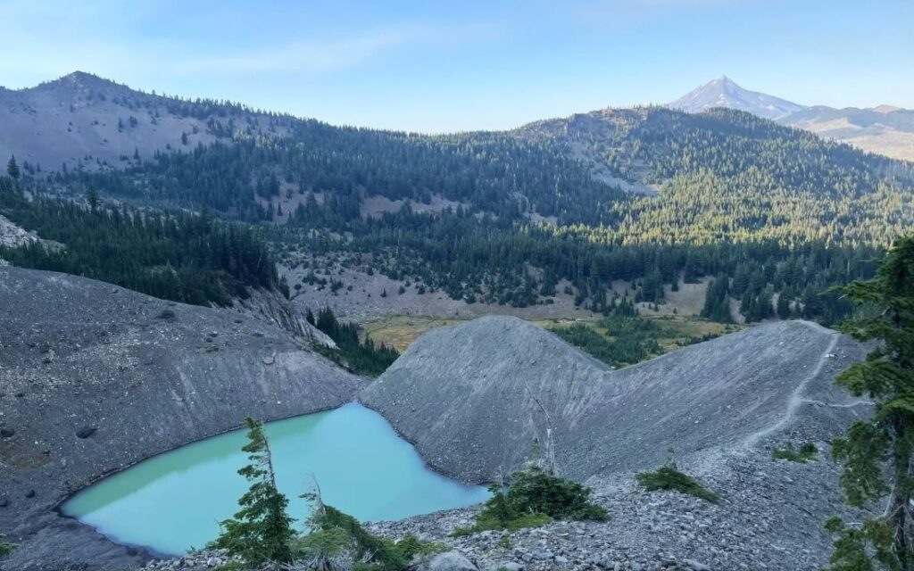
No Name Lake – A Stunning Alpine Lake
No Name Lake is a beautiful alpine lake that has glaciers most of the year. There are two main ways to access No Name Lake.
Distance From Bend: 24 miles, 38 km
Length: 10 – 14 miles
Difficulty: Hard
Elevation Gain: Variable
Known for: Turquoise alpine lake with stunning views
Permits/Fees: Cascade Wilderness Permit
The first option is to start from the Todd Lake Trailhead. This hike is around 14 miles round trip.
The second option is from the Three Creek Lake trailhead via the Tam McArthur Rim Trail. This way is about 10 miles round trip.
Both routes are stunningly beautiful and highlight incredible views of the central Oregon Cascade Mountains.
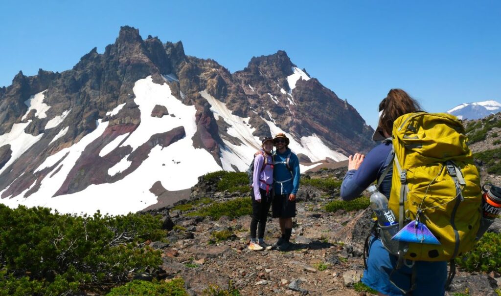
No Name Lake is a beautiful turquoise green that contrasts well with the sparkling white glaciers and the rugged Broken Top Mountain. Take a dip in the ice-cold water if you dare!
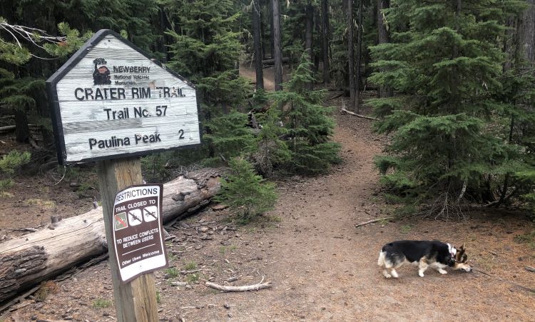
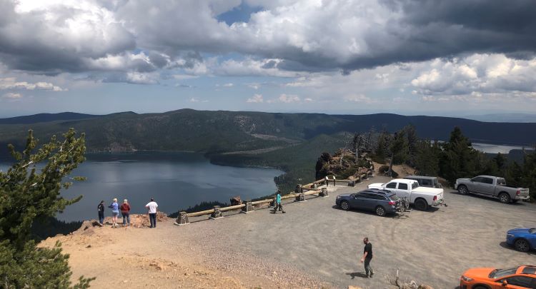
Paulina Peak Trail – Sweeping Views in an Active Volcano
The Paulina Peak Trail takes hikers from Paulina Lake up 1,600 feet to Paulina Peak, the highest point in the Newberry National Volcanic Monument.
Distance From Bend: 36 miles, 45 minutes
Length: 4 – 6 miles
Difficulty: Moderate
Elevation Gain: 1,600 feet
Season: May to October
Permits/Fees: No
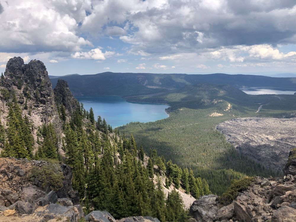
Paulina Lake is one of two lakes (the other is East Lake) located in the Newberry Caldera, which is actually the caldera of an active volcano! There is evidence of historical volcanic activity in the lava fields and the unique topography of the area.
You can start this hike at the Paulina Lake boating site (about 6 miles round trip) or along the National Forest Development Road 500 (about 4 miles round trip).
The trail ascends to Paulina Peak, which you can also drive to if you want to skip the hiking part!
Also, there are lots of other cool hikes in this area including the Paulina Lakeshore Loop and the Little Crater Trail.
Local tip: Paulina Lake and East Lake have so much to offer and make a great weekend trip. Stay at one of the lakeside resorts or campgrounds. Learn more in our full article about the Newberry National Volcanic Monument.
Hikes Near Bend: 1 Hour Drive and Further
If you can expand your range into the 1-to-2-hour drive distance, you can explore even more epic hiking trails in central Oregon.
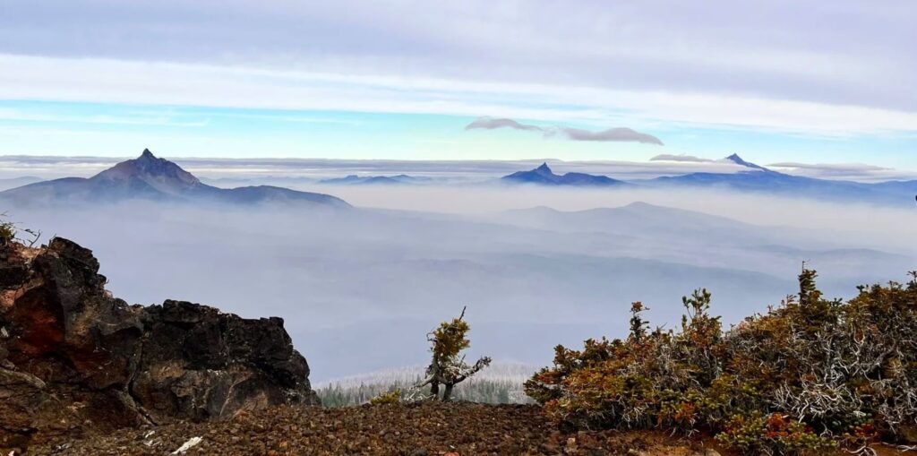
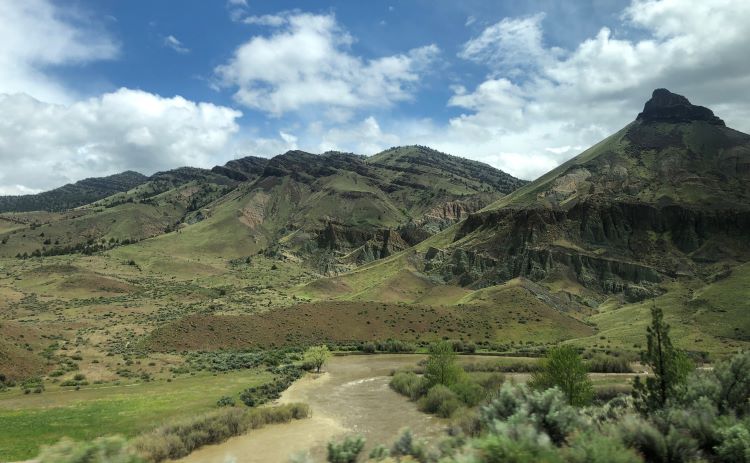
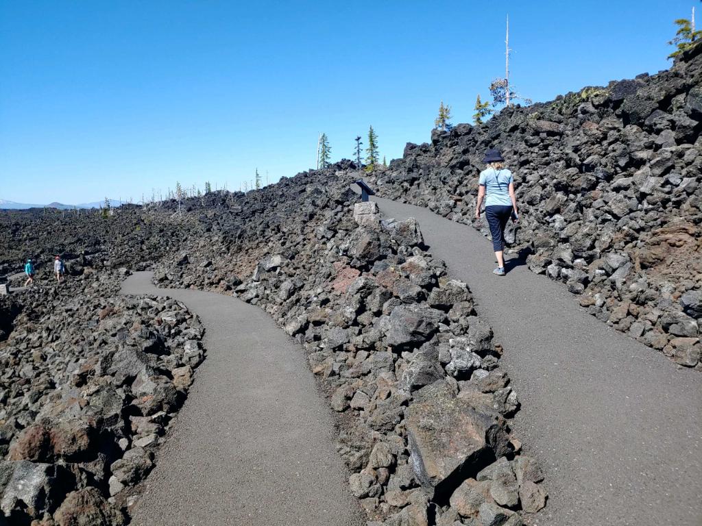
Black Crater Trail – A Harsh Landscape with Great Views
The Black Crate Trail summits Black Crater and is known for its rugged lava rock landscapes and mountain views.
Distance From Bend: 35 miles, 1 hour
Difficulty: Hard
Length: 7 miles
Elevation Gain: 2,300 feet
Season: Late June to October (depending on road closures)
Permits/Fees: Free, self-issue Wilderness Permit
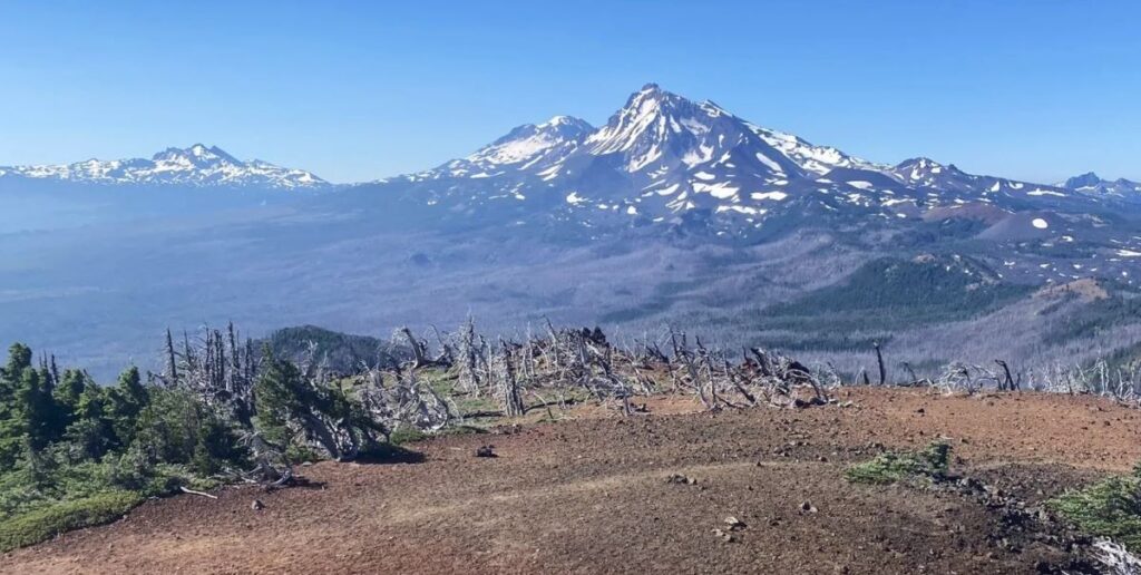
This trail passes through burned area for the first 3 miles or so before ascending through sparse but healthy forest at the top.
Overall, this is a lesser trafficked trail showcasing harsh landscapes of the high desert and beautiful mountain views.
Local tip: There are lots of other cool hikes and viewpoints to explore nearby Black Crater along the McKenzie Highway. We recommend checking out the Dee Wright Observatory and any other pullouts that look interesting.
Keep in mind: The McKenzie Highway is open seasonally, typically from late June to November.
Canyon Creek Meadows Loop – Unique Landscapes
The Canyon Creek Meadows Loop provides a glimpse into the Mt. Jefferson Wilderness as well as up-close views of Three Fingered Jack.
Distance From Bend: 46 miles, 1 hour and 10 minutes
Difficulty: Moderate
Length: 7.5 miles
Elevation Gain: 1,600 feet
Season: Late June to October
Permits/Fees: Central Cascades Wilderness Permit
This hike starts at the Jack Lake Trailhead, which does require a Central Cascades Wilderness Permit for day use access.
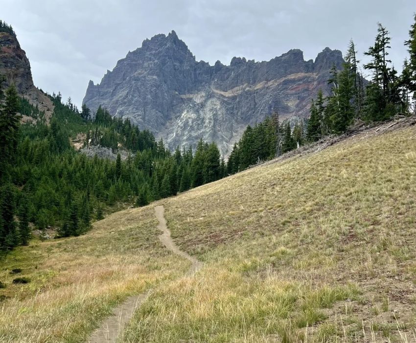
Besides the impressive rock formations of Three Fingered Jack, other highlights include beautiful wildflowers and a small turquoise alpine lake.
Local tip: You can even sometimes see mountain goats on this trail!
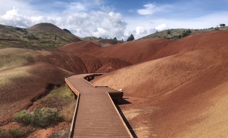
Painted Hills – Colorful Hills
A list of the best central Oregon hiking trails wouldn’t be complete without including the Painted Hills, one of Travel Oregon’s 7 wonders of Oregon.
Distance From Bend: 86 miles, 2 hours
Season: Year-round (preferably without snow)
Permits/Fees: None
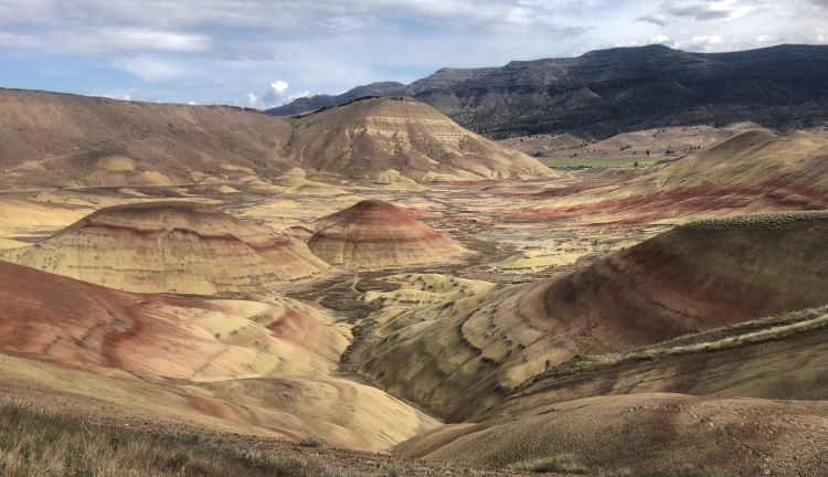
The Painted Hills have become famous for their otherworldly colorful hills and tell a story of rich geology history.
There are 5 short hikes within the Painted Hills unit. Each individual Panted Hills hike is relatively short and all five can be done in under three hours, accounting for plenty of time to soak in the views.
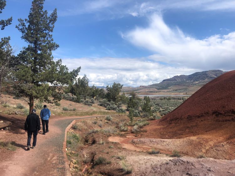
If you’re short on time, don’t miss the Painted Hills Overlook Trail and the Carroll Rim Trail.
| Painted Hills Hike | Length | Highlights |
| Painted Hills Overlook Trail | 0.5 mile / 0.8 km | Views of the main painted hills area. |
| Carroll Rim Trail | 1.6 mile / 2.6 km | Highest elevation viewpoint. |
| Painted Cove Trail | 0.25 mile / 0.4 km | Intimate and immersive colorful hills. |
| Leaf Hill Trail | 0.25 mile / 0.4 km | Interesting piles of slate rock. |
| Red Scar Knoll Trail | 0.25 mile / 0.4 km | A quirky red colored hill. |
The Painted Hills are just one of three units that make up the John Day Fossil Beds National Monument. Definitely check out the other two units if you can.
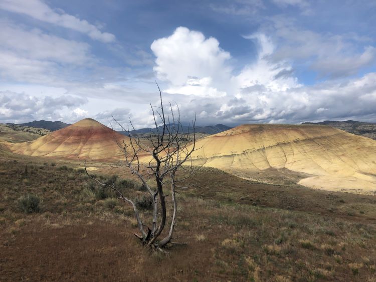
Local tip: Try to visit on a sunny day. Also, if you can go on a day after it rains the colors of the hills really pop!
Blue Basin Overlook – Unique Geology
Speaking of the John Day Fossil Beds, the Blue Basin Overlook Trail showcases the incredible Blue Basin within the Sheep Rock Unit.
Distance From Bend: 120 miles, 2 hours 30 minutes
Difficulty: Moderate
Length: 4 Miles
Elevation Gain: 1,000 feet
Season: Year-round (best when there’s no snow)
Permits/Fees: No
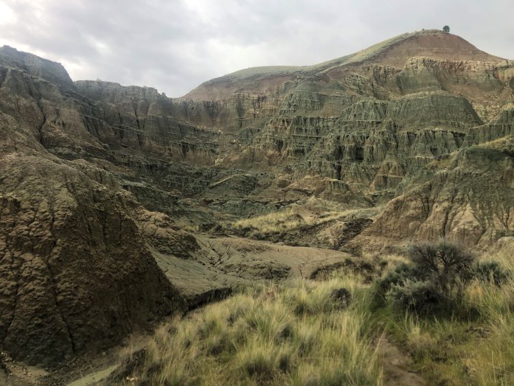
The Blue Basin is known for the muted blue-green color of the rocks, which look really cool in person.
As with the Painted Hills, try to go on a sunny day to see the colors pop (especially if it rained the day before).
Local tip: If you like geology, don’t miss the Thomas Condon Paleontology Center, which has as wealth of interesting information about how this part of Oregon was formed.
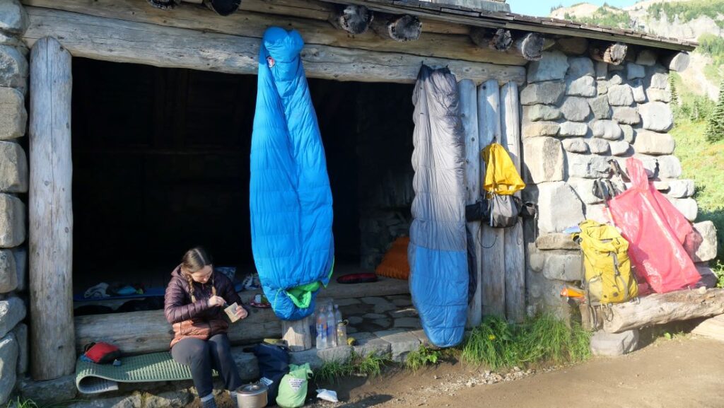
Backpacking Near Bend Oregon
In this article, we also discuss the best central Oregon backpacking trails.
Multi-day hikes in the Cascade Mountains are a great way to get a more immersive experience on the beautiful central Oregon hiking trails.
The table below shows the best trails for backpacking central Oregon has to offer.
| Backpacking Trail | Total Miles | Elevation Gain | Known For |
| Broken Top Loop | 25 | 4,000 ft | Alpine lakes and iconic mountain views. A classic central Oregon backpacking trail. |
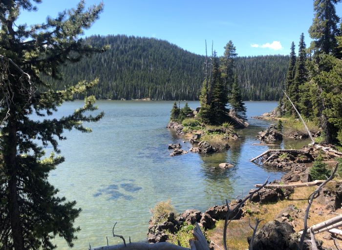
| Six Lakes Trail | Variable | Minimal | Mellow forested hikes with lots of lakes at different distances from the trailhead. |
| Three Sisters Loop | 48 | 7,000 ft | An immersive and challenging loop around all Three Sisters peaks. |
| Camp Lake | 15 | 1,800 ft | A pleasant alpine lake with close-up views of Middle and North Sister. |
In truth, this is just scratching the surface of backpacking near Bend. To see more options, check out our full guide to central Oregon backpacking trails.
Central Oregon Hiking: Other Tips and Resources
The Central Oregon climate and landscape can be intense, rugged, and unforgiving. At the same time, it’s those qualities that lend to its raw beauty and hiking appeal.
That said, it is of the highest priority that hikers prepare adequately before going hiking near Bend.
Get Proper Gear
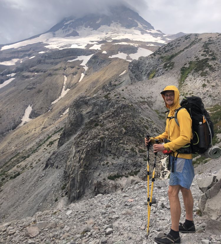
Reliable hiking gear is essential to enjoying the hiking trails in central Oregon comfortably and safely.
We highly recommend a long-sleeved sun shirt with a hood and a hat to keep the intense sun off of you.
Also, sturdy hiking shoes and hiking poles are recommended, as well as trail gaiters and micro spikes if there is snow and ice on the trail.
Check out all the gear we use to stay safe on these hikes near Bend.
Prepare for Weather, Road Closures, and Wildfires
Central Oregon’s harsh high desert climate can change up to 50 degrees Fahrenheit between the highs and the lows.
This means a hot day can turn into a frigid night once the sun goes down. For this reason, we recommend bringing extra layers even during a hot summer day.
For road closures and up-to-date road conditions, the best resource is ODOT’s Trip Check website.
For historical and active wildfires as well as air quality, check out Watch Duty. Unfortunately, the wildfires have been bad in central Oregon in recent years.
Bring Plenty of Water and Food
Bring extra water on your hike. The hot dry summer days can be no joke and will dehydrate you quickly. Don’t get caught out on a hot dusty trail without enough water!
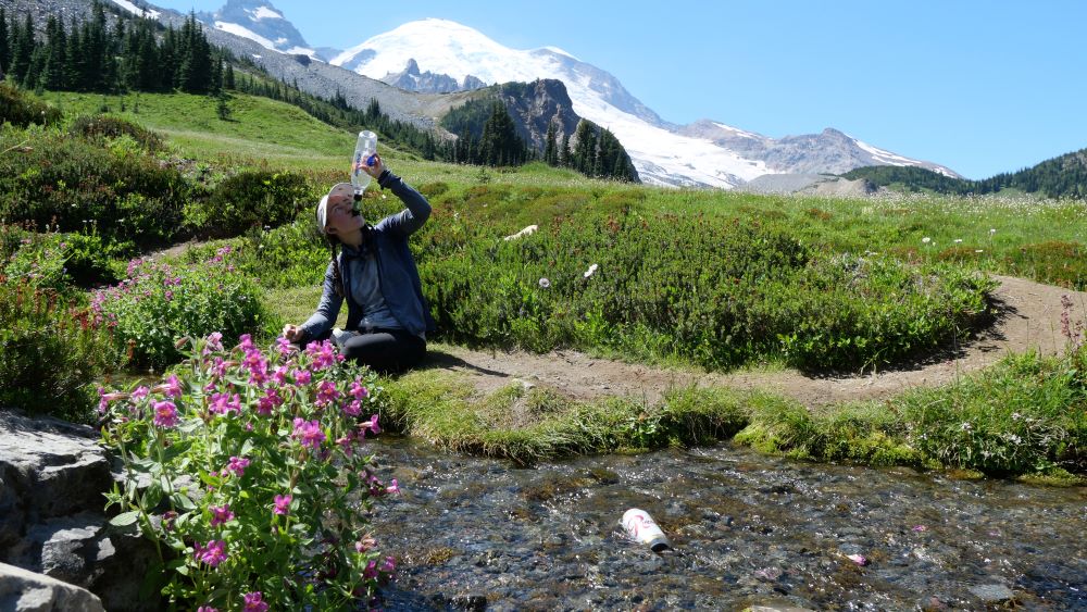
Also, a water filter can be helpful even on day hikes. Here is the one that we use.
Get a Permit (If needed)
Many hikes require a permit, not only for parking at the trailheads but also for hiking the trail itself.
Recently, a Day-Use Central Oregon Cascade Wilderness Permit is required for day hiking in many areas.
Conclusion
Hopefully you feel inspired, informed, and excited to get out there and enjoy the best hikes near Bend Oregon.
We are so lucky to have these incredibly central Oregon hiking trails close by, so please do your part to leave no trace and help preserve them for future visitors.
If you’re visiting Bend, check out more things to do in Bend.
Also, subscribe to our YouTube and follow us on Instagram for more inspiration for exploring the PNW. Happy roaming!
")
 +Map")


")
")