")
No Name Lake Oregon is one of the prettiest lakes in all of Oregon (in our humble opinion).
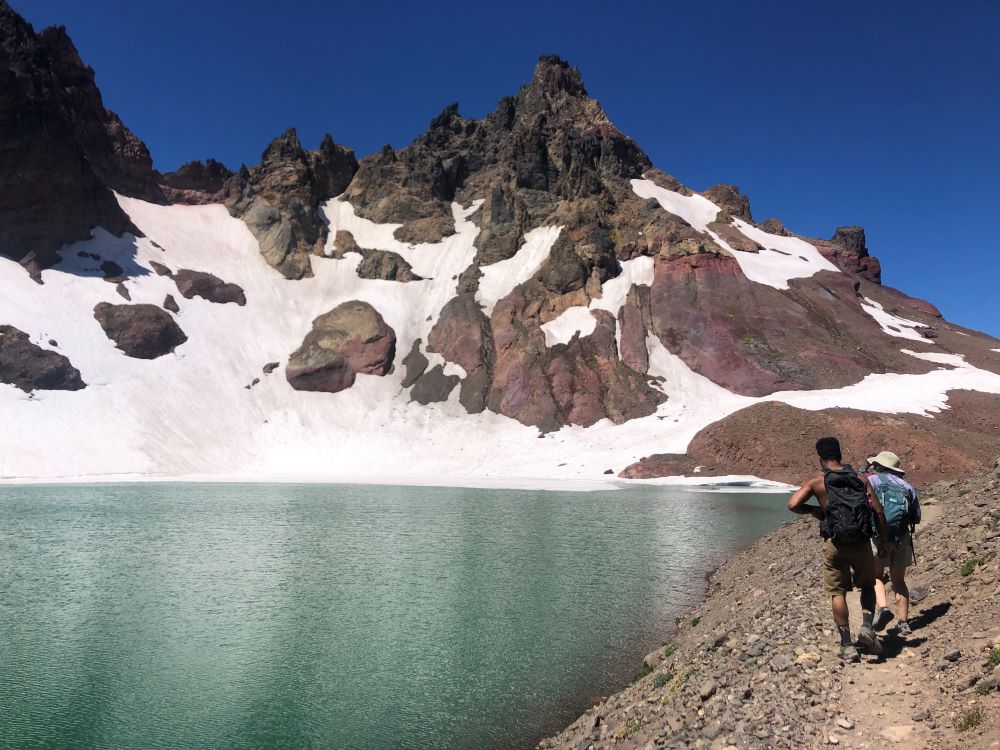
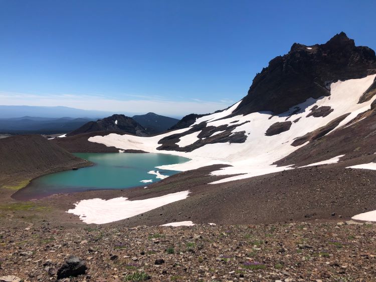
No Name is a stunning alpine lake nestled at the top of Broken Top Mountain in Central Oregon.
There are several hikes to access this serene, turquoise-blue lake. Each hike to No Name Lake has its own unique charm and views.
In this article, we’ll cover everything you need to know about hiking to No Name Lake, including the 4 trailheads, the best views, and our tips.
As Central Oregon resident’s, we think this is one of the best lakes in Central Oregon!
No Name Lake Oregon Hiking Overview and Map
Driving to No Name Lake is not possible. That is, hiking is required, and we promise it’s worth it!
The two primary trails to No Name Lake via Todd Lake Trailhead and via Three Creek Lake (Tam McArthur Rim Trailhead).
We’ll cover both options in detail in the following sections. We also put together a helpful map below.
There are two less common trailheads that require driving on rugged forest roads. It is not advisable to access these trailheads unless you have an offroad vehicle and enjoy using it.
The table below shows the four trailhead options at a high level, and the corresponding hiking information.
| Trailhead | Popularity | Hiking Distance to No Name Lake (Round Trip) | Accessibility | Permit Required? |
| Todd Lake Trailhead | Most | 14 miles | Short dirt road | Yes |
| Tam McArthur Rim / Three Creek Lake | 10 miles | Long dirt road (regraded in 2023) | Yes | |
| Crater Ditch Trailhead | 8 miles | Rugged forest road | Yes | |
| Broken Top Trailhead | Least | 6 miles | Rugged forest road | Yes |
Personally, we prefer starting from Todd Lake Trailhead or Tam McArthur Rim Trailhead. because we don’t have a vehicle that we trust for the rugged forest roads required to access the other trailheads.
No Name Lake Hiking Map
Use the map we created below to see the hiking routes to No Name Lake. You can expand the map to view the full map in a new window.
Hopefully this map of No Name Lake helps you get your bearings and plan your trip!
Todd Lake to No Name Lake Hike
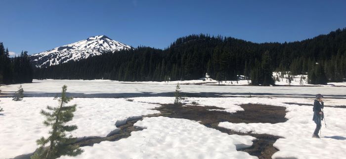
Todd Lake to No Name Lake is the most popular trail to No Name Lake. This 14 mile out-and-back hike is fairly gradual with only a few steep sections.
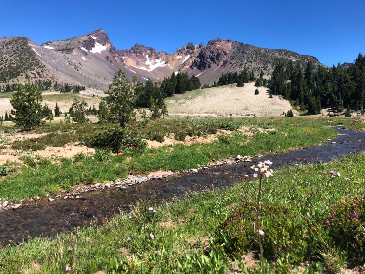
The hike begins at Todd Lake Trailhead and borders Todd Lake before climbing up to a flat section, crossing a few streams, and winding up to No Name Lake.
This trail is fairly exposed but does have a few refreshing shady sections. The total elevation gain is around 2,700 feet but it doesn’t feel steep.
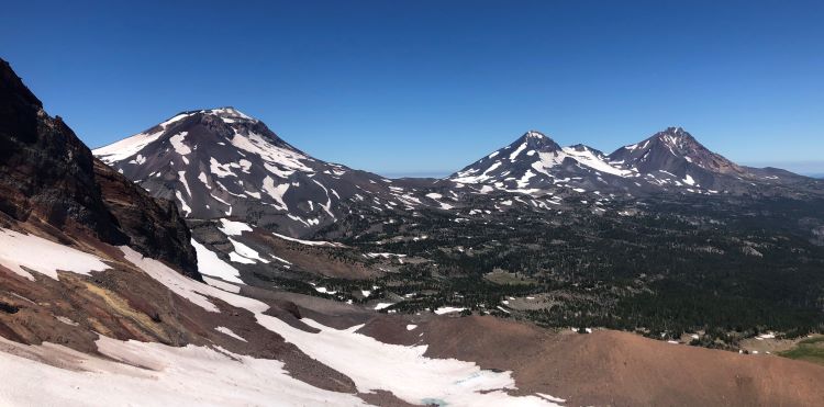
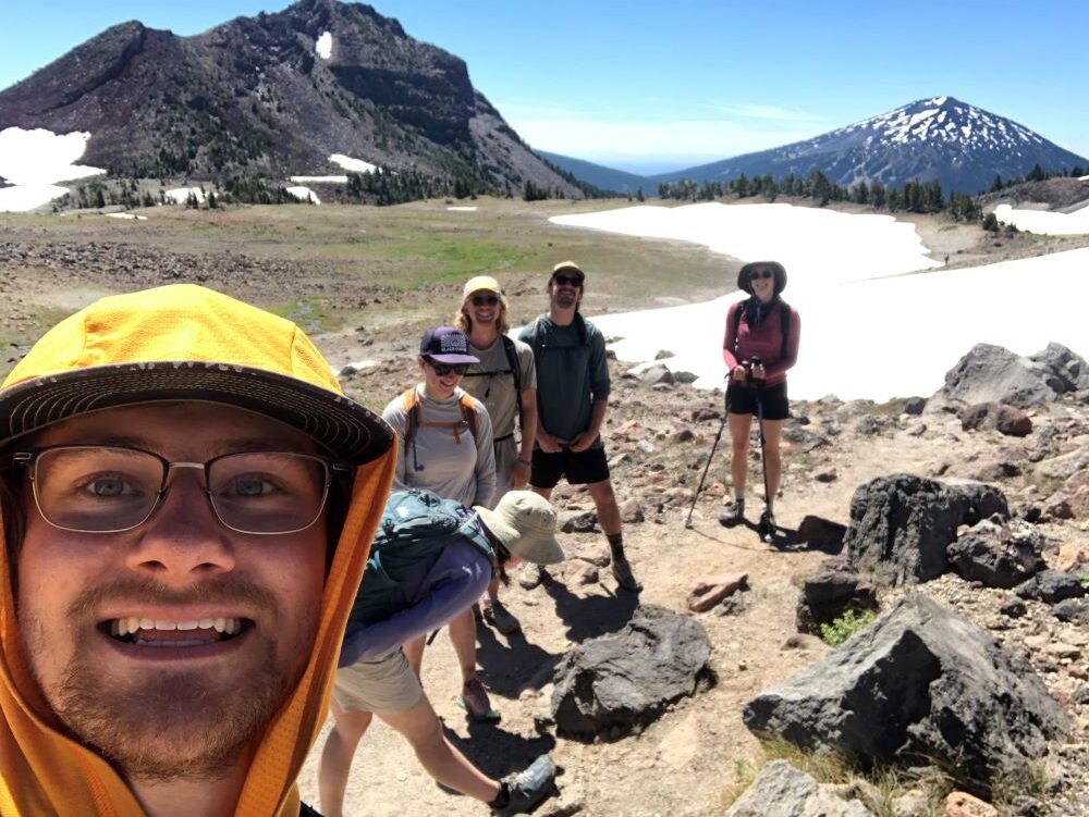
As you climb higher, you are presented with beautiful views of the cragged Broken Top peak and the expansive Central Oregon landscape, including Mt. Bachelor (home of Mt. Bachelor Ski Resort), south of the Cascade Lakes Scenic Byway.
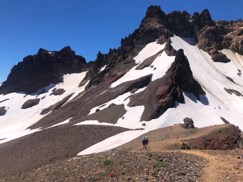
The final ascent to No Name Lake is probably the hardest part, but the reward is worth it. The crisp and refreshing lake unveils itself, welcoming you to have a seat and take in the beauty.
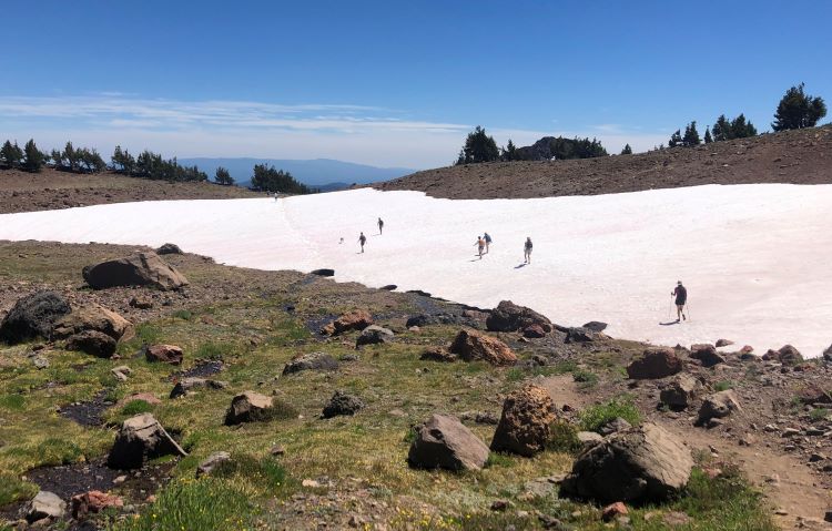
There may be some patches of snow through July and even into early August, depending on the year, but they are easy to cross and do not inhibit navigation.
If you do this hike before the middle of July, you might expect more snow.
Local tip: If you have some extra energy, continue hiking north until you reach the ridge above No Name Lake. This viewpoint will provide vistas of the Three Sisters, Mt. Washington, Three Fingered Jack, Mt. Jefferson, Mt. Hood, and on a clear day, some of the peaks in Washington!
Tam McArthur Rim Trail (Three Creek Trailhead to No Name Lake)
Another popular way to hike to No Name Lake is from Three Creek via the Tam McArthur Rim Trail.
This trail starts on the northeast side of Mt. Bachelor (Todd Lake is south) and follows the Tam McArthur rim for over 1000 feet of elevation gain and over 2 miles. In total this entire out-and-back hike is about 10 miles.
Then, the trail continues west towards No Name Lake and is relatively flat the rest of the way, before descending into the depression that surrounds the lake.
The road into Tam McArthur Trailhead is gravel for about 5 miles. However, it was regarded in 2023 to be nice and smooth, making it accessible for most vehicles.
This hike has excellent views of the Cascade Mountains to the North and the surrounding Central Oregon landscape.
Overall, the Tam Mcarther Rim Trail is one of the best hikes in Central Oregon in our opinion.
Other Options for Hiking to No Name Lake
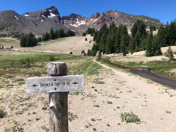
There are two other ways to access No Name Lake. That is, via Crater Ditch Trailhead and Broken Top Trailhead.
These trailheads are closer to the lake than the more popular routes already mentioned. However, that requires driving on a rough forest road that requires a vehicle with good ground clearance.
Via Crater Ditch Trailhead
To access this trailhead, drive to Todd Lake Trailhead, then continue on forest road 370 until you see forest road 378 on the left. Continue until you arrive at the trailhead.
Your extra time in the car saves a few miles compared to hiking from Todd Lake Trailhead. Instead, hiking from Crater Ditch Trailhead is about 8 miles to No Name Lake and back.
Via Broken Top Trailhead
Instead of turning left on forest road 378, continue until forest road 380 on the left. This is the closest spot you can drive to in order to access No Name Lake.
Your efforts are rewarded with a shorter, but still challenging, 6-mile round-trip hike.
Our Tips for Planning Your Visit
We’ve done lots of hiking in Central Oregon and have made our fair share of mistakes along the way. These are our tips for visiting No Name Lake, but these really apply to any hike in Central Oregon also!
Bring Water
All of the hikes to No Name Lake are exposed with little shade. Water is essential if you are going to last. There are many streams along the way where you can filter water.
Sun Protection
Sun protection is essential. Bring reliable sunscreen or a sun shirt and a good hat. Also, sunglasses are critical if there is snow. Your eyes will thank you.
Get a Permit
A Central Cascades Wilderness Day Use Permit is required regardless of the trailhead you start from. Rangers do actively check your pass!
When we went most recently, there was a ranger at the trailhead checking permits. Also, we’ve heard lots of other people see rangers checking permits as well.
Leave No Trace
Don’t be that person who leaves trash in a pristine natural area. Also, don’t go off trail into sensitive vegetation. Those plants are trying their best to survive in the harsh climate here.
Take Advantage of Restaurants in Bend
There are so many amazing options for coffee, restaurants, and breweries in Bend. We highly recommend stopping on your way out or when you return from your hike!
No Name Lake FAQ
Can you drink water from No Name Lake?
Yes. The lake is purely snowmelt, and there is a glacier that persists most of the year. There was a herd of elk that got stuck in the snow back in 2018 that made drinking the water questionable. However, they have since decayed and the water is pristine again.
Do you need a permit?
Yes. Regardless of what trailhead you start from, a Central Cascades Wilderness Day Use Permit is required.
We recommend being prepared to snag a permit right when they open the access. This is one of the most popular hikes in Central Oregon.
How long is the hike to Broken Top?
As mentioned previously, the length of the hike depends on the trailhead you start from. No Name Lake is almost at the top of Broken Top. See the table at the beginning of this article for milage numbers.
How hard is it to hike Broken Top?
Regardless of the trailhead you start from, the hike to No Name Lake is difficult, but doable for many people. There are some steep sections, but also some flat parts. The exposure to the sun makes it difficult on hot days.
Do I need a permit to hike Todd Lake?
There is a 2-mile trail around Todd Lake that does not require a permit. Simply show up and hike. However, a permit is required if you hike towards No Name Lake.
Conclusion
We hope you found this information helpful when planning your hike to No Name Lake. If you’re visiting Central Oregon, welcome!
We want to help you make the most of your time here. Be sure to check out our other articles about Central Oregon.
If you’re in the planning stages of your visit, be sure to check out the best things to do in Bend and where to stay.
")
 +Map")


")
")